
- Home
- Companies
- Eye4Software B.V.
- Software
Eye4Software B.V. software
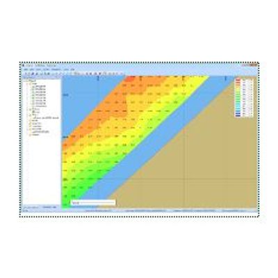
Eye4Software - Model Hydromagic - Single Beam Hydrographic Survey Software
Eye4Software Hydromagic is a professional hydrographic survey package, which can be used to map depth areas using an echo sounder and GNSS receiver. The software is very affordable and the learning curve is very short. You can start creating your first sounding within a single day. Our website contains a lot of free training material so you will be able to learn the software without expensive courses.
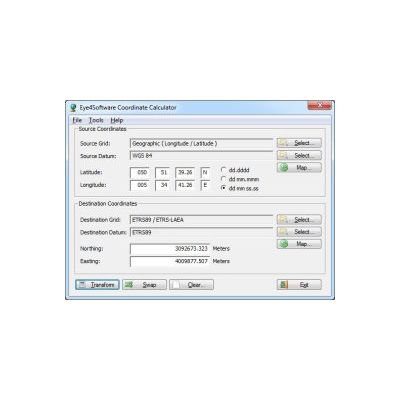
Eye4Software - Coordinate Calculator
The Eye4Software Coordinate Calculator is an easy to use (freeware) desktop software tool, to convert coordinates from one coordinate system to another. It can also be used to convert coordinates between different horizontal map datums. The software can be used to convert a single coordinate, or to convert a batch of, for example, gps coordinates read from a comma separated file. The software is shipped with a SQLite database containing almost any reference ellipsoid, map datum and coordinate system around. It is possible to modify the coordinate systems, reference ellipsoids and geodetic datum definitions stored in the database. You can also create user defined coordinate systems, reference ellipsoids and map datum definitions, so you can always extend the database.
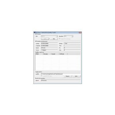
Eye4Software - GPS Toolkit
Eye4Software Hydromagic is a professional hydrographic survey package, which can be used to map depth areas using an echo sounder and GNSS receiver. The software is very affordable and the learning curve is very short. You can start creating your first sounding within a single day. Our website contains a lot of free training material so you will be able to learn the software without expensive courses.