

FarmFacts GmbH software
NEXT Farming Office
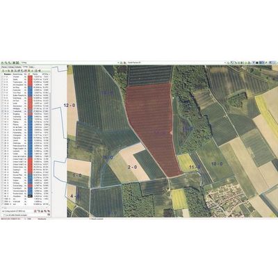
Next - Model GIS Office - Subarea Management Software
The background view shows current areal images while several map layers can be activated to show field boundaries and field groups. All this data can be directly linked to NEXT Field Card IndexOFFICE or NEXT Subarea ManagementOFFICE. You can measure areas and distances, design areas or overlap them. Several tools allow for the export (e.g. PDF) and printing of your chosen maps. Using the import and export functions you can link your NEXT GISOFFICE to many other applications. NEXT GISOFFICE For example, you can import areas from Google Earth. Using the free layer administration tool you can import all desired geodata directly to your GIS, save it and use it with all other GIS operating data.
Next Farming Package
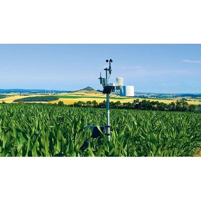
Next Basic Package - Weather Station Software
As a farmer, you need to make the right decisions for your farm every day!
The NEXT Weather StationPACKAGE provides you with the right management tool to do this: With the NEXT Weather StationPACKAGE, you receive an integrated system for recording, documentation, analysis and prognosis of weather data.
Next Farming Service
Next Geodata Service - Current and Official GIS Data Programming Software
NEXT GeodataSERVICE supplies current and official GIS data for all areas. The material serves as a planning and management basis, increasing yield reliability and quality with the objective of a sustainable, integrative and environmentally friendly agriculture.
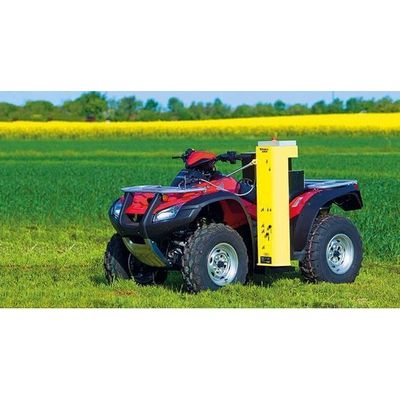
Next Service - Soil Sampling Software
Soil analysis for main nutrients is an essential basis for business-specific, cost-effective fertilisation. A well planned, reliably implemented and DGPS-supported sampling ensures representative soil samples. The subsequent analysis in the laboratory indicates reliably whether and where within the business areas the nutrient supply of your plants is at risk.