

- Home
- Companies
- Geoscanners AB
- Products
Geoscanners AB products
Systems & Control Units - Integrated Systems
Geoscanners - Model SPG-2309 - Integrated System
The new SPG2309 is the continuation of Geoscanners’ development in airborne Ground Penetrating Radar systems. This unit combines a newly developed acquisition electronics, quieter data path and an excellent antenna design. All of this provides the user with a much cleaner data as well as faster acquisition times.
Geoscanners - Model SPG-2203 - Integrated System
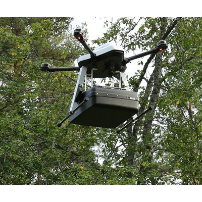
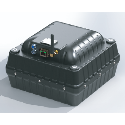
The SPG2203 air-born ground penetrating radar system is a state of the art survey device specifically designed to be mounted on UAVs. The system contains all the required parts to efficiently acquire and store underground survey data at high speeds. The data can be transferred to the control computer via the Ethernet port, WiFi link or stored on board on the SD Card mounted on the device.
Geoscanners - Model Goldie-21 - Integrated System
Goldie 21 is designed from the start to be an easy to deploy, lightweight GPR detector for medium to high penetration depths. The WiFi connectivity and internal batteries makes this unit ideal for use when cables are in the way of surveys or can get tangled with tree branches or leaves.
Systems & Control Units - Control Units
Akula - Model 9000B - Radar Control Units
Akula 9000B is Geoscanners’ longest available and most often sold GPR radar control unit. The great amount of features and large number of system configuration possibilities all contribute to Akula 9000B’s popularity. Because Akula 9000B is compatible with Geoscanners’ antennas with center frequencies up to 1000MHz, depending on the configuration, it covers the needs of multiple survey industries. From geological to concrete surveys, the feature rich Akula 9000B will provide excellent results and successful surveys. Each user receives a
system tailored for their particular needs thanks to the large number of antennas that can be used with Akula 9000B.
Systems & Control Units - Complete Systems
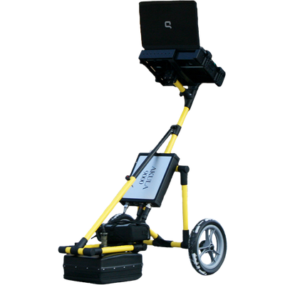
Geoscanners - Model U-Explorer - Complete Survey Systems
U-Explorer is an all-in-one complete survey solution for many different types of surveys focusing on shallow to medium depth investigations. It has a combination of top of the line Geoscanners products that are calibrated and matched, so that the system can be used as soon as it arrives.
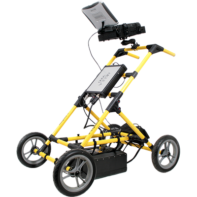
Geoscanners - Model U-Explorer-mini - Complete Survey Systems
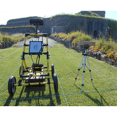
Comes included: Ground Coupled Antenna (GCB-200 to GCB-700), Akula 9000C Control Unit, SVC-821 4-wheel survey cart with an integrated survey wheel, Laptop, GPRSoft PRO one year subscription, GAS Acquisition Software, Charger, Accessories, Control cable, GPS.
Antennas - Airborne
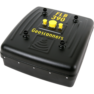
Geoscanners - Model FLB-390 - Ground Penetrating Airborne Antenna
FLB-390 is an air launched ground penetrating antenna developed specifically to cover the needs for non- contact antennas in applications where full contact is not possible. The side lobe isolation properties of FLB-390 are exceptionally good, even though this can be a problem area for air launched antennas in general.
Antennas - Borehole
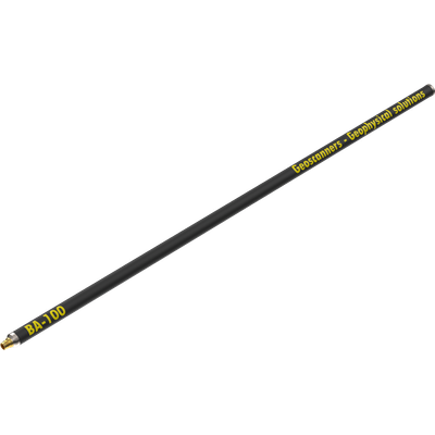
Geoscanners - Model BA-100 - Borehole Antenna
Borehole antennas are used to extend the amount of information one can get from a drilled borehole. By collecting GPR data with a borehole antenna one can observe and interpret the obtained data showing the media around the borehole at a certain depth. Borehole antennas are used to extend the amount of information one can get from a drilled borehole. By collecting GPR data with a borehole antenna one can observe and interpret the obtained data showing the media around the borehole at a certain depth. BA-100 is a borehole antenna for applications requiring access to the features via a nearby borehole. In addition to the higher penetration and clean signal, the size of BA-100 is much smaller than any other competitors’ products with the similar specifications. It is an ideal tool for companies surveying marble quarries, salt mines or any other application requiring borehole antennas with
lower frequency operating bandwidth.
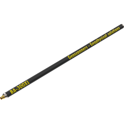
Geoscanners - Model BA-300 XL - Borehole Antenna
Technical specifications: Dimensions - Ø38x1238mm. Weight - 1.7kg. Frequency - 305MHz. Range - 64-256ns. Maximum Cable Length: 350m. HS code - 85291095.
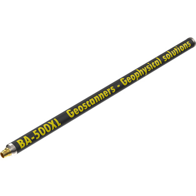
Geoscanners - Model BA-500 XL - Borehole Antenna
Technical specifications: Dimensions - Ø38x860mm. Weight - 1.45kg. Frequency - 485MHz. Penetration depth - 4m. Resolution target size in low conductive soil - 0.1m. Range - 20-150ns. Maximum Cable Length: 350m. HS code - 85291095.