

GeoServ
3 services found
GeoServ services
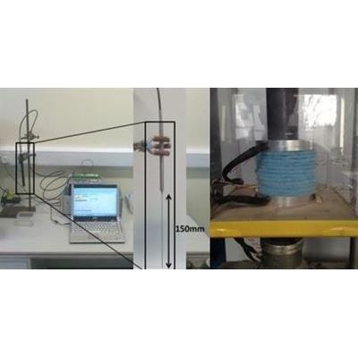
Thermal Conductivity Tests
GeoServ are equipped to conduct professional thermal conductivity measurements on a wide variety of materials. We utilise the steady state method with a custom engineered Divided Bar setup this is the most practical method for testing rock core samples in the laboratory. We also employ the transient heat method with the use of a thermal probe, this test method is applicable for both undisturbed and remolded soil specimens and soft rock specimens.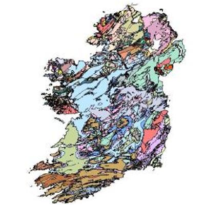
Geographic Information Systems (GIS)
GeoServ understands the importance of compiling and presenting geographical data in a way that allow our clients to improve critical decision making as part of our project development operations. GeoServ use GIS to capture, store, analyse and manage a wide range of geographical data. We provide GIS to natural resource sectors allowing a graphical representation of gathered data. (for data storage options please contact our team)