
Hélicéo products
Technologies - Drone Photogrammetry
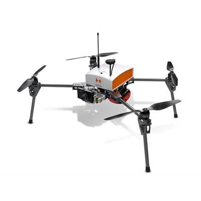
Hélicéo - Model Fox4 - Professional Multirotor Drone
The smart drone for mapping and inspection. The Fox4 is a multirotor drone with 4 carbon blades. Its light structure and engine allow for extreme maneuverability with manual piloting. Designed for automatic photogrammetry missions up to 1.5 km², Fox4 may also carry out missions for inspection of infrastructure, structures, network lines or industrial sites, in automatic or manual mode
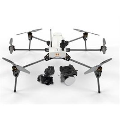
SuperFox - Model 6 - Lidar and Photogrammetric Drone
Multiply your flight time by 3 with the 43 minutes autonomy of the SuperFox6. The SuperFox6 drone surveyor has 43 minutes autonomy. Thus, it triples the capabilities of its predecessor: the Fox6. A single flight of SuperFox6 is equivalent to 3 flights of Fox6. In addition, this aerial multi-rotor drone is fully automated. It can carry out a wide variety of topographic surveys up to 150 hectares (370 acres). The SuperFox6 drone surveyor is designed for large photogrammetric missions. It allows the orthophotos, point clouds and DTM production. It is also compatible with the new Hélicéo LiDAR System.