IDSi International software

Solidblox - ERP Suite
SOLIDBLOX helps businesses manage construction faster and more profitably. At the core of SOLIDBLOX is a comprehensive, end-to-end ERP suite specifically designed for multi-site construction businesses. High performance features built on industry best practices help you address financial, departmental, and operational requirements of your business through one platform
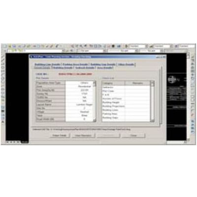
AutoPlan - Computer Aided Design (CAD) Based Software
AutoPlan is a Computer Aided Design (CAD) based software that automatically checks drawings and plans submitted by Architects and Engineers for approval prior to the construction of a structure.
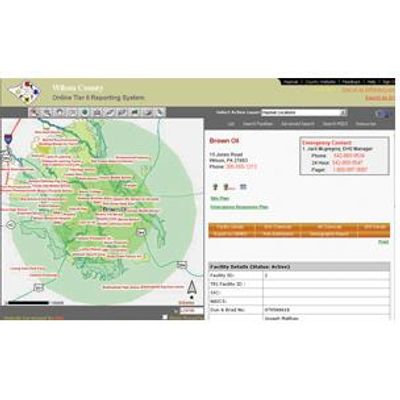
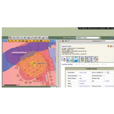
IDSi - Model TIER II Manager - Emergency Planning and Community Reporting Software
Streamline and accelerate extremely hazardous material compliance, planning, and emergency response with the trusted web based solution to meet SARA Title III, Emergency Planning and Community Right-to-Know mandate.

IDSi - Incident Collaborator Software
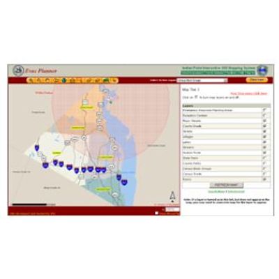
EvacPlanner - Web-Based Evacuation Preparedness Tool
The EvacPlanner provides a web-based evacuation preparedness tool for citizens living close to hazardous sites, within the 10/50 mile radius of a nuclear plant, or other at-risk areas such as flood zones. The EvacPlanner™ delivers personalized response information to identify appropriate evacuation routes and response measures. Using the EvacPlanner™, citizens living in an at-risk area can identify their emergency reception centers, driving directions, and emergency alert systems. The EvacPlanner™ requires minimal training and can be directly linked to a State and County`s GIS data. The EvacPlanner™ can be integrated with weather packs, highway, and demographics databases, and works with the rest of IDSi International`s suite of Emergency Response applications for more complete emergency response planning and execution.
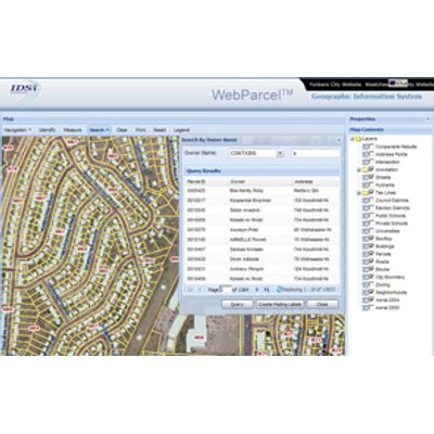
WebParcel - .NET with ArcGIS Server
The WebParcel is a powerful GIS Viewer powered by optimized Searches and Reports to enable users to easily search, map, and easily share vast amounts of parcel, road, and other infrastructure information and reports through a single application.