

Inertial Labs, a VIAVI Solutions Company software
Software

Inertial Labs - Sensor Based Graphical User Interface (GUI) Software
Engineered for end-users across various industries, the Sensor Based Graphical User Interface (GUI) provides customers with the capabilities for detailed data analysis while maintaining simple interfacing.
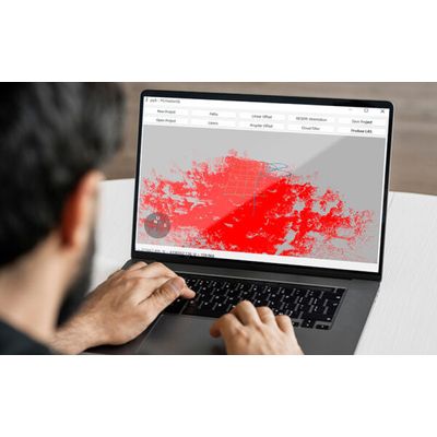
Inertial Labs - Model PCMaster - LiDAR Point Cloud Software
Engineered for partners and resellers in the remote sensing industry, PCMaster is the LiDAR point cloud generation software for Inertial Labs’ breakthrough LiDAR Remote Sensing Payload Instrument, RESEPI.
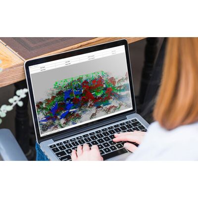
Inertial Labs - Model PCPainter - LiDAR Colorization Software
PCPainter is Inertial Labs’ .las colorization software. This is done by projecting images from the integrated camera over the .las file. As a result, each point is colorized to reflect the images captured in flight.
Inertial Labs - Model ROCK - LiDAR Point Cloud Software
Inertial Labs recommends the ROCK Cloud for all LiDAR point cloud processing. The ROCK Cloud is an entirely cloud-based software where users can upload, share, manage, and process RESEPI LiDAR data. The ROCK Cloud gives users all the tools to get a deeper analysis of their point cloud for vegetation management, hydrologic modeling, and much more. PCMaster produces LAS files in WGS 84 datum and UST projection zone, the ROCK Cloud is an excellent tool for users looking to convert LAS files in a local datum and preferred projection coordinate system.