
Interactive Oceanographics software
Streamline Software
Streamline-ENV - Environmental Monitoring Software
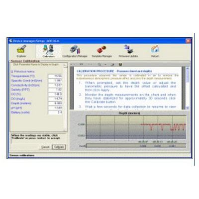
Streamline-ENV is a comprehensive software solution designed for environmental monitoring professionals. Users worldwide praise the numerous features and credit the intuitive design for helping `Streamline` their environmental monitoring project. A brief overview, below, highlights the main features of Streamline-ENV. The links on the left allow you to explore Streamline`s features and benefits in detail.
Streamline-GEO - Bathymetric Survey and Water Quality Mapping System Software
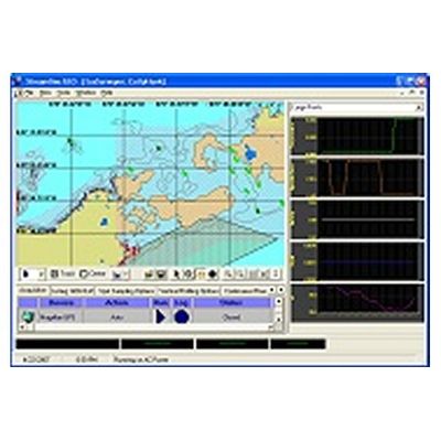
Streamline-GEO is a hydrographic and water quality mapping system that interfaces with NMEA GPS devices, YSI sondes, Airmar SmartSensors, and Turner Field Fluorometers (10-AU-005-CE) to create a unique environmental survey system. Streamline-GEO makes it easy to perform bathymetry surveys, outfall mapping (temperature, wastewater), dye studies, vertical profiles and 3D mapping in reservoirs, rivers, lakes and coastal regions.
Streamline-SBP-SS - Integrated Software System
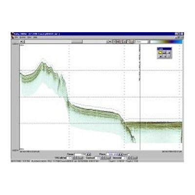
Streamline-SBP-SS is an integrated software system designed to enhance the post-processing capabilities of Bathy 2000/2000P series high resolution sub-bottom profilers manufactured by. Streamline-SBP-SS (formerly named Bathy-2000W Shore Station`) is designed to process and perform technical analyses of Bathy 2000 and 2000P sub-bottom data and to provide the user with easy-to-use visualization and archive management tools. Streamline-SBP-SS operates as a `Shore Station`; providing post-processing functionality and visualization of data previously collected by Bathy 2000/2000P systems. The shore station version permits scientists to view the sub-bottom data after it has been offloaded from the Bathy 2000P system. Streamline-SBP-RT is the expanded version of Streamline-SBP-SS that supports integrated real time operation with a Bathy 2000/2000P system.