

Laser Technology Inc (LTI) products
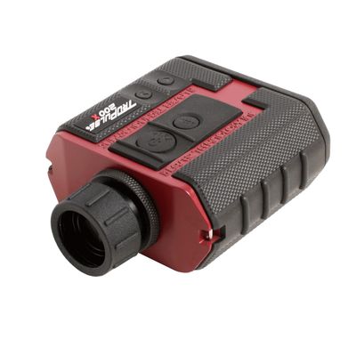
TruPulse® 200X - Laser Rangefinder
The TruPulse 200X laser rangefinder makes high precision mapping measurements for professionals working in challenging field conditions. Use the device`s lidar technology to measure slope distance and inclination and calculate horizontal distance, vertical distance, height and 2D missing line values. The TruPulse 200X can withstand harsh conditions with its rugged, waterproof housing. Add a TruPulse 200X to your toolkit to simplify your next project in mining, pole audit, forestry, infrastructure, site inspection, inventory, and more. Has Bluetooth® connectivity with most iPhones, Windows, and Android™ operating systems.
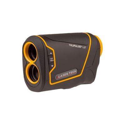
TruPulse L2 - Laser Rangefinder
The TruPulse L2 versatile handheld laser measures much more than just range. Measure slope distance and inclination angle and calculate horizontal distance, vertical distance, height and 2D vertical missing line values. The TruPulse L2 is more accurate and provides calculations not found on recreational rangefinders giving you the ability to produce professional results. Take advantage of Laser Tech’s Advanced Targeting Modes (Closest, Farthest, Continuous and Filter) and TruTargeting technology so you know exactly what accuracy level is being achieved.
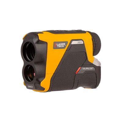
TruPulse® 360i - Laser Rangefinder
The TruPulse 360i fuses a tough, highly accurate, and intuitive next-generation rangefinder design with our patented TruVector 360° Compass Technology, enriching your laser measurements with azimuth data. This rugged unit is built to last with a lightweight and strong magnesium chassis and rubber-armored aluminum housing for a 100% waterproof rating. The TruPulse 360i replaces previous TruPulse 360°, TruPulse 360°B, and TruPulse 360° R models with 50% higher distance accuracy and 60% higher inclination accuracy while increasing the overall effective range by 25%. Faster target acquisition speeds and new feedback features boost confidence in each measurement. Including azimuth data with your measurements allows for efficient, single-shot positioning of remote features and 3D point-to-point calculations, a major advantage when completing projects that require accurate asset location and facility mapping.

TruPulse® 200i - Laser Rangefinder
The TruPulse® 200i is capable of 50% higher distance accuracy and 60% higher inclination accuracy than the previous TruPulse 200 and TruPulse 200B models while increasing the overall effective range by 25%. Faster target acquisition speeds and new feedback features boost confidence in each measurement. Faster target acquisition speeds and visual, audible, and tactile feedback give you confidence with every measurement. Bluetooth Dual Mode expands connection capabilities, making this tool even more versatile for any workflow. Challenging targets are no match for the ultra-bright HUD with 5 brightness levels to work in any lighting condition. This laser rangefinder is built to work as hard as you do with a lightweight and strong magnesium chassis, and rubber-armored aluminum housing giving it 100% waterproof rating.
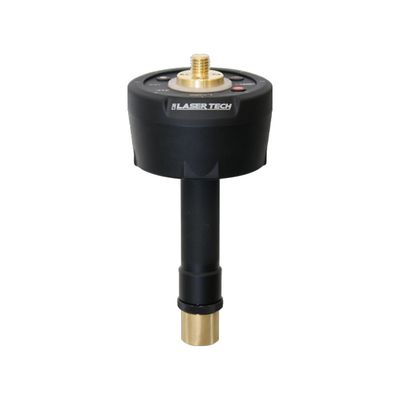
MapStar® TruAngle II® - Angle Encoder
The MapStar® TruAngle II® encoder precisely calculates a turned horizontal angles that can be referenced to any desired point or direction. This survey-pole-mounted angle encoder works with TruPulse® products to provide high-accuracy X, Y, and Z coordinates for a complete 3D mapping system immune to local magnetic interference. The intuitive user interface complements this next-generation angle encoder`s advanced performance and stronger durability with an all-new, feedback-driven user experience. Add your preferred GNSS receiver to map assets with a TruPulse rangefinder. Introduce the Distance-Angle workflow to your toolkit and experience a new world of offset positioning possibilities; map assets within a clear line of sight without occupying their physical location, avoid dangerous terrain and private property, reduce traverse time, and overcome signal issues.