

MeteoStar - A Division of Sutron Corporation software
LEADS - Leading Environmental Analysis & Display System
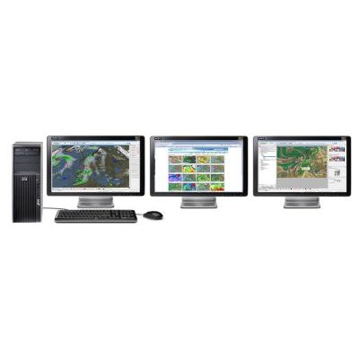
LEADS is a cutting-edge weather toolkit, which allows for the ingest, integration, processing, storage, and visualization of virtually any type of meteorological/environmental data. LEADS provides scalable, versatile weather solutions for forecasters, decision-makers and overall support applications within your business or country. LEADS can be configured to run on a variety of hardware and operating system set-ups, allowing for the ingest and database of all available meteorological data, fusing of data, and automatic creation of a web-based product database of defined forecast products. These products can then be distributed with the full LEADS Forecaster Workstation or using LEADS On-Line to users and forecasters.

LEADS - Model On-Line - Web-Based Companion- Meteorological Toolkit Software
LEADS On-Line earns its innovative reputation by delivering high-quality, world-wide weather products to professional meteorologists and decision makers continuously across a simple internet connection. With LEADS On-Line, users are assured that they will always have the most professional, comprehensive, up-to-date weather forecasting tools and datasets at their fingertips!
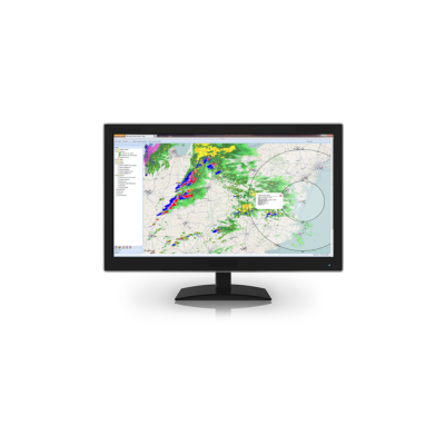
LEADS iGM - Online Weather Mapping System
MeteoStar’s newest addition to our product line, LEADS On-Line Interactive GIS Map (iGM), is a complete web-based situational awareness display that allows the integration of not only standard hydro-meteorological data sets, but customer unique data as well. As LEADS iGM is a web-based display, allowing for access not only from multiple internal locations, but can also to your customer base with a simple internet connection.
LEADS - Model EMS - Environmental Monitoring System Software
LEADS EMS (Environmental Monitoring System) is a commercial system for collecting, integrating, and processing meteorological, air quality, and water quality data. The system delivers accurate data for display in near real-time, providing agencies with the most proficient environmental monitoring solution available.

Enhanced Softcopy Mapping Software (ESMS)
Enhanced Softcopy Mapping Software (ESMS) is a high speed toolkit for use by those with time critical data. ESMS is the third generation of the SMS product line that includes both SMS and SMS+. ESMS was a complete overhaul of SMS+ to allow for 24-bit color at 8-bit color speeds.
MeteoStar - Satellite Integrated Weather Data Reception Software
High resolution satellite imagery provides a valuable data source for weather visualization and aviation weather forecasting. The high resolution satellite imagery is supported by several international satellites. These satellites consist of constellations of geostationary and low earth orbiting satellites. Combined with a comprehensive set of LEADS-Magellan image processing tools, weather guidance and forecast products can be generated and distributed to users for a variety of applications ranging from general weather, aviation, air traffic control and pilot briefings.