

- Home
- Companies
- MeteoStar - A Division of Sutron ...
- Software
- LEADS - Leading Environmental Analysis ...
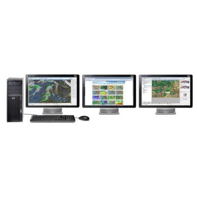
LEADS - Leading Environmental Analysis & Display System
LEADS is a cutting-edge weather toolkit, which allows for the ingest, integration, processing, storage, and visualization of virtually any type of meteorological/environmental data. LEADS provides scalable, versatile weather solutions for forecasters, decision-makers and overall support applications within your business or country. LEADS can be configured to run on a variety of hardware and operating system set-ups, allowing for the ingest and database of all available meteorological data, fusing of data, and automatic creation of a web-based product database of defined forecast products. These products can then be distributed with the full LEADS Forecaster Workstation or using LEADS On-Line to users and forecasters.
LEADS is your professional, powerful solution for...
- Meteorological Operations
- Aviation Weather Support
- Marine Forecasting
- Environmental Monitoring
- Agricultural Forecasting
- ATC Operations
- Flight Weather Briefings
- Emergency Management
- Sensor Integration
- Power & Utilities
- Hydrological Applications
- Scientific Research
The LEADS solution is both dynamic and flexible, which allows for integration into any existing architecture. This powerful toolkit provides a tailored, integrated, turn-key solution to any organization`s decision-making and operational support needs.
Multi-Layered Products
Multiple images and data layers are fully supported in LEADS. You can build products which allow you to turn visibility on and off for each layers, along with viewing the actual values contained in each layer.
Calculators & Functions
MeteoStar has incorporated algorithms from agencies within the US Air Force, Lockheed Martin, and Raytheon, and universities like Texas Tech and Oklahoma. This allows single button computations of parameters such as the Knapp-Ellrod Turbulence Index, Panofsky, Showalter, Bulk-Richardson, and many more.
High-Quality Graphics
LEADS allows you to shade or shadow any layer within a product. This provides broadcast-quality detail and adds significant value to any LEADS produced image!
Symbols, Fronts, and Logos
Our software includes comprehensive support for meteorological drawing tools, along with a standard set of line, polygon and shape tools. It contains a complete set of WMO and ICAO symbols, fronts, and even custom user symbols, which let you import your own logos, symbols or images. This set of tools is the most complete anywhere, and can be extended to include the ones you create.
Automation
LEADS contains a simple scripting language that records all events as you build products and perform tasks within the software. This allows you to easily repeat common practices with a single button click. Save files, build charts, perform advanced algorithms— if you can do it in LEADS, you can make it scriptable, interactive, and automatic. This powerful capability sets LEADS apart from many other products as it allows you to tailor a complex system down to a single set of buttons that perform exactly the functions you need. Meteorologists need to concentrate on the weather, not the software!
Preference Settings & Permissions
LEADS allows users to apply preferences on either a global or individual basis. Access can be given on a user or group basis for all critical LEADS functions. You decide who is allowed access to specific functions, giving you flexibility to maintain your system security without mission compromise.
Cross-Platform Compatibility
Thanks to the use of our QT libraries, all LEADS systems are cross-platform compatible. Our software solutions run in both Microsoft Windows (2000, XP, 2003 Server, Vista, 7) and Linux (Red Hat, Debian, and SUSE).
GTS & TTY Switch Integration
LEADS comes standard with GTS and TTY pre-processors, allowing for ease of integration with your in-situ GTS and/or TTY switches.
International Language Support
MeteoStar can convert all LEADS menu items, dialogs, and panels into your native language. Our customers have already helped us translate English to Spanish, Polish, French, and Portuguese. Language settings are kept as a user preference, allowing each user to choose their own language.
The LEADS solution is a net-centric weather monitoring and forecasting solution, which can be closely integrated into all of your forecasting, planning, operational, distribution, and tactical activities. The enhanced weather forecasting analysis and warning capabilities provided with the LEADS solution will speed up decision making processes by providing the highest quality, pinpoint weather information in a machine-to-machine (M2M) ready format. This allows operational users to run automated decision rules and receive reliable, consistent answers. The advantages of the LEADS solution are numerous and span different market segments and needs:
- Complete sets of weather data ingest, management, editing, and visualization tools
- LEADS® can be run manually, or configured to run scripts which generate and distribute weather products automatically, 24-7
- Large, diverse, and international customer base, both military and commercial, supporting constant software enhancements based on operational user feedback
- Experience in the industry; over 15 years arming businesses with a market-leading solution
- Generate and re-sell high-resolution weather graphics from your own LEADS® system
- Scalable LEADS® Forecaster Workstation functionality, specifically designed to deliver full forecast product sets via the web when bandwidth limitations exist.
- Integrated system monitoring and alerting tools
- Complete WMO/ICAO standard bulletin and chart creation tools
- Comprehensive user and administrator training programs, taught by weather professionals for weather professionals
- Robust alerting mechanisms, customized to organizational and user needs