
- Home
- Companies
- Microdrones GmbH
- Products
Microdrones GmbH products
Integrated Systems - mdLiDAR
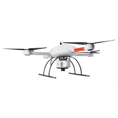
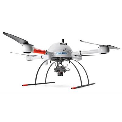
Microdrones - Model mdLiDAR3000 - LiDAR Drone System
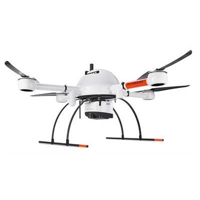
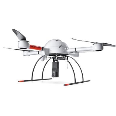
Microdrones - Model mdLiDAR1000 - Drone Based LiDAR System
This is the UAV, hardware, software, workflow, training and support that surveying professionals need.
Integrated Systems - mdMapper
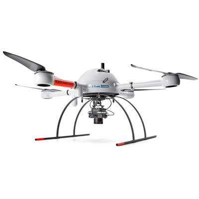
mdMapper - Model 1000DG - LiDAR Drone System
mdMapper1000DG is a true game changer. With this aerial surveying solution, you’ll achieve the highest level of data accuracy currently possible, cover more ground in one flight, use less people and equipment on jobs – all without using ground control points. Significantly reduce your time spent on projects. Deliver unparalleled data quality. Become invaluable to your clients’ success. A complete uav mapping solution that cuts cost, saves time, and pushes limits – without GCPS. Conquer large surveying or mapping projects in a fraction of the time and master your geospatial data by putting direct georeferencing to work for you.
mdMapper - Model 1000PPK - LiDAR Drone System
mdMapper1000PPK fills an important niche for customers who may not be ready for DG, and are willing to set up 1 – 3 ground control points for their projects. And when your business, projects or services expand to require DG, this system is easily and affordably upgradeable via a DG READY firmware update. Powerful Accuracy with just 1 – 3 Ground Control Points. Microdrones customers asked for a system that could deliver excellent results with a handful of ground control points. We listened.

mdMapper - Model 1000+ - LiDAR Drone System
This system provides all of the capability of the mdMapper1000 system that you know and trust, but via an easy, affordable firmware update, you’ll enjoy a full PPK or DG system without any physical or hardware upgrades! Many users needed basic GCP intensive aerial surveying, but wanted to keep the option to upgrade open. The Microdrones mdMapper1000+ builds on the classic mdMapper1000, but it’s PPK Ready or DG Ready when you are!
Integrated Systems - mdTector
mdTector - Model 1000CH4 - LiDAR Drone System
mdTector, from Microdrones, is a lineup of professional aerial inspection solutions. mdTector1000CH4, is a fully integrated aerial methane inspection package. It’s purpose-built for professionals who are responsible for inspecting methane gas infrastructure.
Drones
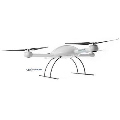
Microdrones - Model md4-3000 - Heavy Lifting Drone
Professionals who need a UAV that works harder should consider the md4-3000, the Microdrones aircraft that can carry more, fly longer, and reach higher. The md4-3000 is our largest aircraft. It can handle heavy LiDAR sensors, professional mapping grade cameras, multiple sensors, and more. If you’re looking for a UAV that allows you to go above and beyond, md4-3000 is the strongest choice in the industry.