

Pear Technology Services Ltd. software

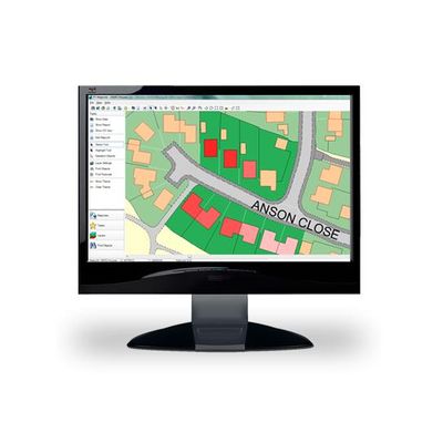
PT-Mapper - Core Application for Creating Maps Software
PT-Mapper is a versatile but easy to use Windows program for creating, editing and maintaining a wide variety of maps. It has been designed specifically to meet the requirements of non-IT professionals such as Land Agents, Farmers, Town and Parish Clerks, Business Managers, Grounds Managers – all those who wish to use digital mapping as an aid to running their business but who don’t have the time, budget or inclination to invest in the type of mapping/GIS used by large organisations.
MapLink - Linking Software
If you are the type of business that wants your data at your fingertips MapLink is for you. By linking your maps to databases or spreadsheets you can produce reports and create management with ease giving you the information where and when you need it.
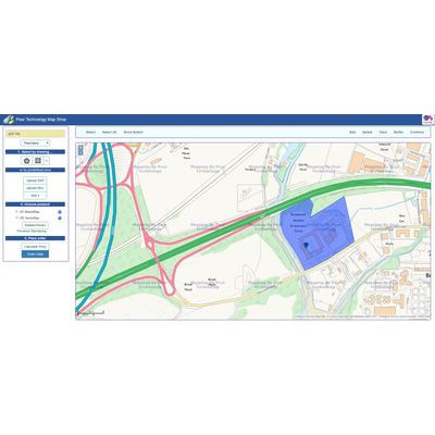
Map Shop - Online Access Map Data Software
The easiest way to access map data. Map Shop is a brand new, 24/7, online service exclusive to PT-Mapper customers. Instantly search, select and download Ordnance Survey data directly into PT-Mapper.
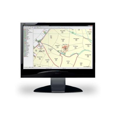
PT-Mapper - Farm and Estate Mapping Software
Our PT-Mapper software allows you to centralise information on tenancies, ownerships, properties, cropping, forestry plantings, utilities, Rights of Way, event planning, moorland management, environmental areas, ELS/HLS schemes – in fact, all the geographically-based information you are likely to need. Each topic can be brought to the map at a click of a button, areas measured, modifications made, and prints created or emailed at any scale on any size paper. By visualizing information in a purpose-designed package, management can become more effective and plans better communicated to others.