
Phoenix LiDAR Systems products
Other Products
Phoenix-Slam - Conquer Gps-Denied Mapping System
The new Phoenix SLAM, slated for an early-2019 release, makes Phoenix LiDAR products more versatile by offering a dependable tool for mapping GPS-denied environments, such as underground mines and indoors.
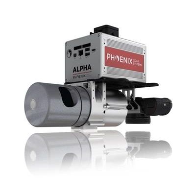
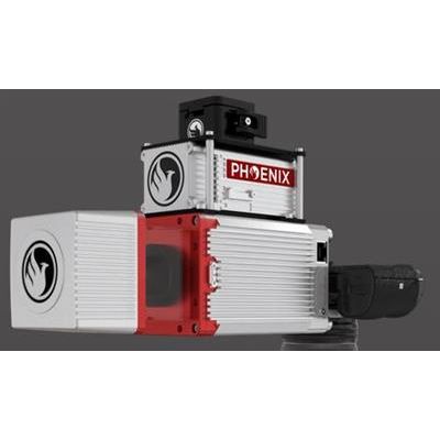
Alpha - Model AL3-32 - Powerful Mid-Range LiDAR System
The Alpha AL3-32 is a powerful mid-range LiDAR system, with a recommended max scan height of 65m AGL. Named for its 32 lasers that emit 700k pulses per second, this system accepts up to two returns per pulse, potentially doubling the amount of data captured by a single laser pulse. As a result, the mid-priced AL3-32 produces dense point clouds for challenging mapping projects where altitude, speed, and even heavy vegetation may become factors. Most importantly, this LiDAR system, designed by surveyors for surveyors in the field, is easily upgradeable for future LiDAR sensors.
Scout Series
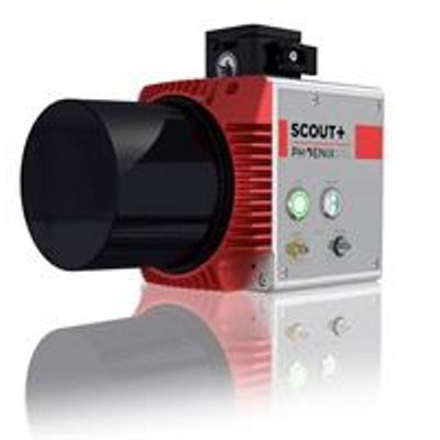
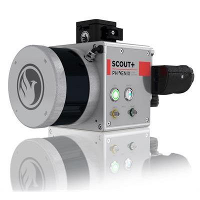
Phoenix Scout - Model 8 - LiDAR System
The Phoenix Scout-8 is the newest addition to the SCOUT Series, taking cost-effective LiDAR scanning to new heights with a 60-meter recommended AGL and up to 3 returns. Customize your SCOUT-8 with photogrammetry, hyperspectral, thermal imaging and additional options.
Phoenix Scout - Model 16 - LiDAR System
The Phoenix Scout-16 is an excellent entry-level, lightweight system with a 40 meter recommended AGL. A strong fit or smaller scan areas and teams on a budget, the Scout-16 also features options for photogrammetry, hyperspectral, thermal imaging, and more.. Phoenix LiDAR Systems and AP Equipment Financing have partnered to provide you with the most comprehensive financing programs for your LiDAR mapping needs. Restrictions may apply.
Pioneer Series
Pioneer - Model P10 - Long-Range Laser Sensor
The Pioneer P10`s long-range laser sensor highs only 3.8kgs and is a purpose-built, UAV LiDAR mapping system with a high-power 1550nm laser.
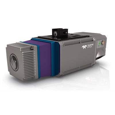
Pioneer - Model P-360 - Universal Survey Grade Lidar Mapping System
With a measurement precision of <1cm, thePioneer P-360will capture survey grade data for the most demanding application requirements. The complete system, with integrated dual oblique 24MPix cameras, weighs only 4.65kg; making it suitable for most mid-class commercial unmanned aircraft and robust enough for manned heli applications. ThePioneer P-360supports of wide range of operating parameters in pulse repetition rate, range, and lines per second to allow it to be optimized for the application and data requirements.
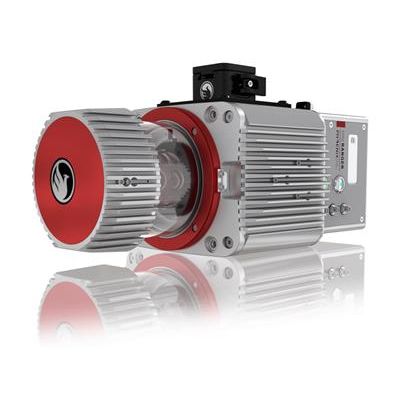
miniRANGER Series
Phoenix miniRANGER - LiDAR Systems
This system features an impressive recommended AGL of up to 75 meters, filling a major AGL gap in the lightweight UAV LiDAR market. With the photogrammetry package, operators of mid-size multirotors, like the DJI M600 Pro, can now simultaneously acquire survey-grade LiDAR data and high resolution 42 MP RTK photogrammetry at up to 100 m operating flight altitude. Available in UAV, vehicle, and backpack configurations.
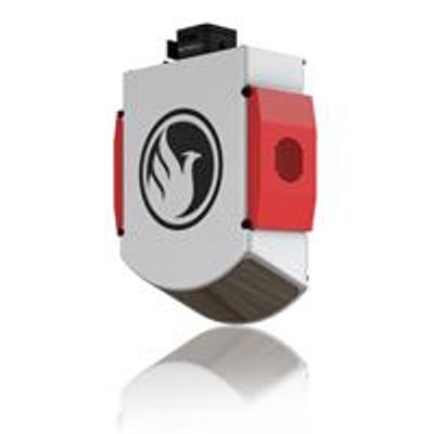
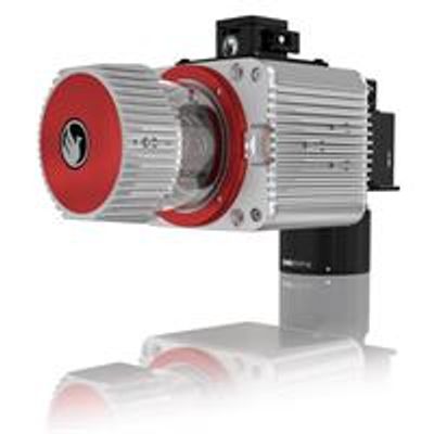
miniRANGER-LITE - LiDAR Systems
This system features an impressive recommended AGL of up to 75 meters, filling a major AGL gap in the ultra-lightweight UAV LiDAR market. With the photogrammetry package, operators of mid-size multirotors, like the DJI M600 Pro, can now simultaneously acquire survey-grade LiDAR data and high resolution 42 MP RTK photogrammetry at up to 100 m operating flight altitude. With options for photogrammetry, multispectral, hyperspectral, and thermal imaging, the miniRANGER is one of Phoenix’s most popular and flexible systems. This system is available in UAV, vehicle, and backpack configurations.
Ranger Series
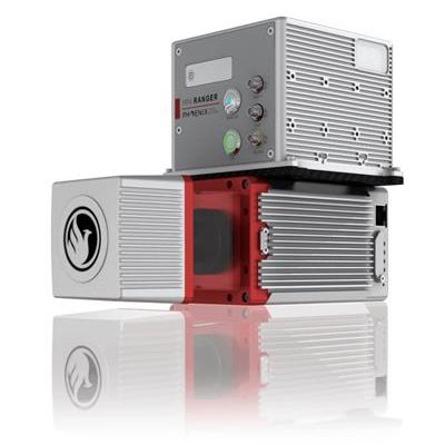
Ranger - Model LRT - Long Range LiDAR Systems
The RANGER LR is the Long Range system configuration of our RANGER Series. Designed for the most demanding mapping applications, the RANGER LR features a powerful 1,350 nm laser that penetrates dense vegetation at high speeds and altitudes in large scan regions. This system is available in UAV, manned aerial, automotive, VTOL and backpack configurations.
Ranger - Model LR LITE - LiDAR System
The RANGER-LR LITE is the new lighter Long Range system configuration of our RANGER Series. Designed for the most demanding mapping applications, the RANGER-LR LITE is the ultimate combination of high density, long range LiDAR with a powerful 1,550 nm laser that penetrates dense vegetation at high speeds and altitudes in large scan regions. This system is available in UAV, vehicle, VTOL and backpack configurations, depending on your needs.