

Planetek Italia s.r.l. software
2d and 3d Data Analysis
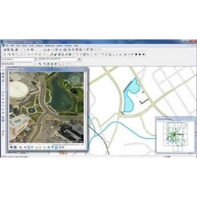
GeoMedia - GIS Management Package
GeoMedia is a powerful GIS management package which provides simultaneous access to geospatial data in almost any form, uniting them in a single map view for efficient processing, analysis, presentation, and sharing.
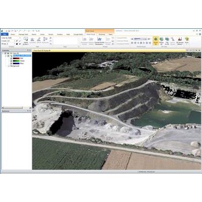
ERDAS IMAGINE - Geospatial Data Authoring System
ERDAS IMAGINE the world’s leading geospatial data authoring system, incorporates geospatial image processing and analysis, remote sensing, and GIS capabilities into a single powerful, convenient package. ERDAS IMAGINE enables users to easily create value-added products such as 2D and 3D images, 3D flythrough movies, and cartographic-quality map compositions from geospatial data. Featuring a ribbon interface and custom workflow tabs so you can consolidate your favorite tools, ERDAS IMAGINE makes it easier to access what you need to work efficiently and productively. ERDAS IMAGINE also provides advanced tools for parallel batch processing, spatial modeling, map production, mosaicking, and change detection. In addition, ERDAS IMAGINE also incorporates the ERDAS ER Mapper algorithms, many GeoMedia utilities, and implements OGC standards.
Preciso Index - Geospatial Indexes Software
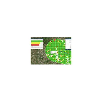
Geospatial Indexes for Territorial Planning and Strategic Environmental Assessment. Monitoring of soil loss. The synthetic and objective representation of the territory and its changes is essential to understand the evolution of anthropic and natural phenomena. Geospatial Indicators can synthesize the principal characteristics of the land through maps and numerical data, describing urban, rural and natural territory and its evolution over time.
Rheticus Safeland - Automatic Cloud-Based Geoinformation Services
Automatic cloud-based geoinformation service for subsidence, landislide and ground motion monitoring and analysis over time. Supporting risk mitigation and prevention activities to safeguard infrastructure, buildings and citizens. Monitoring is essential to assessing and predicting landslides or ground structural weaknesses, which could affect buildings or infrastructures. To get accurate information over areas subject to subsidence or slow moving landslides, in order to anticipate potential risks, is fundamental for geological services, organizations and professionals working in civil protection, master plan management, engineering and insurance companies.