

Rapidis software
Logistics Planner - Route Planning for ArcGIS

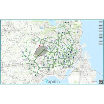
Rapidis - Route Planning and Optimization Extensions Software for ArcGIS
Logistics Planner for ArcGIS, is a suite of extensions for ArcGIS that offers Route Planning, Scheduling and Fleet Optimization to industries where the planning scenarios are industry specific and not always possible to solve with Esri core software like the Network Analyst extension.

Rapidis - High Density Multi Modal Routing Software for ArcGIS
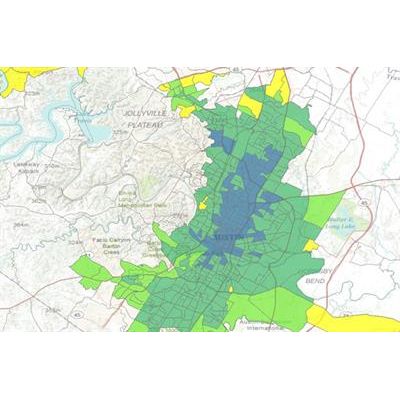
High Density Route Planning is the right choice when you want to visit all addresses in an area. This is often the case for Postal Mail Delivery, Residential Garbage Collection and Total Market Coverage (TMC) with printed advertisement material like folders or leaflets.
Rapidis - Pickup and Delivery Route Planning Software for ArcGIS
Logistics Planner for ArcGIS, Pickup and Delivery edition will route plan and optimize scenarios where a drive order has both a pickup task and a delivery task. This is the case for courier services, demand responsive transport like school buses and medical trips and handling containers with construction waste etc.
Rapidis - Vehicle Routing Problem Software for ArcGIS (VRP)
Logistics Planner for ArcGIS, VRP edition, handles route planning and fleet optimization for organisations with multiple delivery tasks, inspection tasks or service tasks at multiple locations. Rapidis has, over the years, added many functionalities on request from our users. This means that the software handles a wide variety of planning scenarios in several industries. If you evaluate the software and find something missing, Rapidis will most like be able to add what you are looking for.
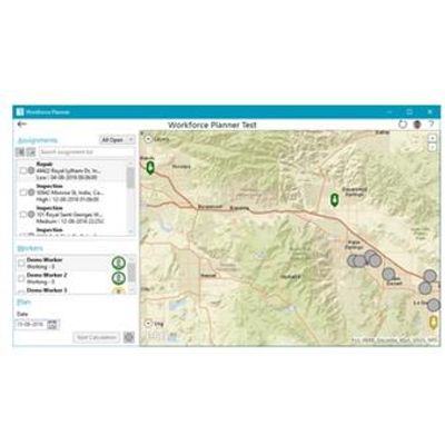
Rapidis - Workforce Planner
Workforce for ArcGIS is included, when you subscribe to ArcGIS Online. Together with other apps for ArcGIS, Workforce for ArcGIS will help you assign orders to your Mobile Workforce or Field Workers and share status of your tasks throughout your organization. Rapidis offers an Add-on App, Workforce Planner, that combines the strengths from Workforce for ArcGIS with those of Rapidis Logistics Planner. As a result, functionalities for automatic scheduling and optimized route planning are added. On a practical level, this means that Dispatchers can select tasks from their pool together with any number of field workers. After a few moments, the dispatcher will see the an optimized schedule for each worker and be sure that he has the most efficient plan for his entire fleet of workers.
Route Planning

Rapidis - Route Planning Software for Inspections And Service Tasks
When Route Planning for service technicians and inspectors the main concern is to minimize the time that your employees spend driving between the jobs assigned to them. With drive time minimized there is more time to solve tasks.
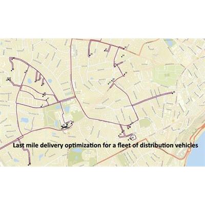
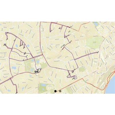
Rapidis - Last Mile Route Planning Software for Parcel Distribution
Most professionals working with last mile route optimization for parcel distribution will attempt to have their resources do as many deliveries per vehicle per day as possible. Obviously they will prefer to assign stops close to each other to the same vehicle. Many organizations have created a network of districts making it easy to decide to which route or vehicle a delivery should be assigned. Both methods have a number of built-in challenges that makes it almost impossible to create exactly the routes that will efficiently utilize a fleet of vehicles and maximize the number of deliveries they can manage to do.

Rapidis - Scheduling and Routing Software for Demand Responsive Transport (DRT)
Passenger transportation that is not covered by scheduled bus routes; also known as Demand Responsive Transport can be both school busses, paratransit, medical trips and more. A request for transport will, in this field, consist of both a pickup and a delivery. In the morning a student is picked up at her home address and brought to her school, institution or perhaps a treatment facility. Later, the same day, the same transport is often carried out in reverse order.
Other Software
Rapidis - Transit Analyst Software for ArcGIS
Transit Analyst is a series of software modules which provide valuable Transit Analysis and insights based on counts, travel card data and modelling:
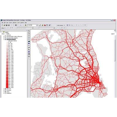
Rapidis - Traffic Analyst Software for ArcGIS
Traffic Analyst turns ArcGIS into a fully functional transportation planning system. The core of Traffic Analyst is a set of advanced modeling tools which plug into the ArcGIS Geoprocessing framework, supplemented by dedicated editing tools for handling public transport lines and timetables.