
Rezatec software
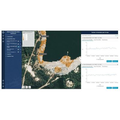
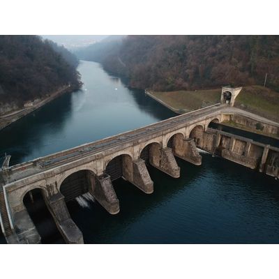
Water SAT: Water Infrastructure & Catchment Management - Dam Monitoring
Rezatec - Geospatial AI for Ground Motion & Seepage
Ground Motion & Seepage is the only product of its kind that remotely provides a detailed historical and current view of structural movement for all your dams – even across inaccessible locations. Its satellite and multiple data feeds fused with advanced analytics deliver the most frequent, accurate insights on unusual changes in ground motion and vegetation change, giving you the power to see developments between routine structural surveys. Its unique historical analysis, combine with continual data refreshes to accurately highlight exact risk areas, which means you deploy your investigation and maintenance resources to the right place at the right time.
Rezatec - Geospatial AI for Downstream Hazard Detection
Optimizing inspection deployment – at scale: Downstream Hazard remotely identifies the building changes that matter in your dam inundation zones, across your whole portfolio and your entire state. It gives you accurate insights on developments between inspections, highlights exact risk areas and keeps tabs on low hazard dam urban change. It enables you to deploy your resources efficiently and flag new building in the inundation zone for review, so you can manage and act on risk.
Rezatec - Geospatial AI for Landslide Risk
The power to see unusual changes between routine structural surveys. Deploy your investigation and maintenance resources to the right place at the right time. Assess risk. Act fast. Landslide Risk identifies and monitors key landslide indicators and determines the highest risk areas cost-effectively, at scale. It fuses multiple satellite, geospatial and trigger-event data, like weather, seismic and construction, with the most advanced analytics available. Its year-round monthly data insights detect areas of landslide risk across your entire dam infrastructure, giving you the foresight to stay on top of issues, deploy the right maintenance resources, and manage cost and safety impacts.
Rezatec - Dam Compliance
Dam compliance data. Made simple. The power to aggregate, streamline and analyse all your dam data. Reduce the staff burden of reporting and focus resources on what they do best. All dam data. In one place. Dam Compliance aggregates into one place and applies powerful analytics to all your dam data, like measurement, piezometer, water levels, rainfall measurements, level surveys and geo technical. It enables you to easily generate reporting, ensure regulatory compliance and keep your dams safe. It combines all your data with Rezatec’s advanced algorithms, AI and analytics. It supercharges your understanding of key trends and points of failure, powers your ability to identify procedural gaps, and enables you to focus your resources on what they do best.
Water SAT: Water Infrastructure & Catchment Management
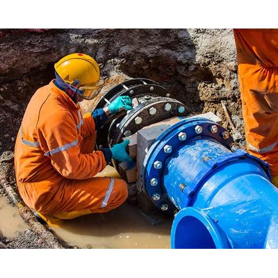
Rezatec - Geospatial AI for Pipeline Risk Monitoring
Focus investment on the top 20% of risks for greatest impact. Use Pipeline Risk to identify highest risk pipeline sections and focus upgrade resources on what matters. Zero-in on what matters: Pipeline Risk enables water leaders to remotely determine the highest risk of pipeline failure across the entire network - and upgrade it - ahead of time. It establishes the likelihood, consequence and cost of failure using satellite and multiple data feeds fused with the most advanced AI on the market. And it’s 10% more accurate than other risk models. Use these constantly refreshed insights to prioritize, plan and optimize investment, drive productivity gains and maximize water value.
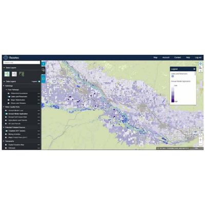
Rezatec - Geospatial AI for Water Quality Monitoring
Track the effects of land use on water quality across wide watersheds. Proactively manage upstream pollution risks to reduce the requirement for costly downstream treatment. Remote. Cost-effective. Scalable. Water Quality empowers water utilities leaders to remotely monitor issues across entire water catchment areas: remotely, at scale, cost-effectively. It predicts land use change and environmental risk, and it provides sub-catchment insights into how land use impacts pollution levels. Satellite and multiple data feeds combine with advanced AI to track changing issues across watersheds. Use it to identify and dynamically manage diffuse pollution levels resulting from changing land use.