

RMSI Private Limited software
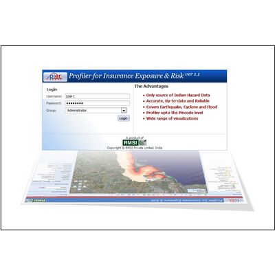
PIER - Profiler for Insurance Exposure & Risk Software
PIER™ is an exposure and risk tracking solution that utilizes geospatial technologies to improve identification, assessment, pricing and monitoring of risk across various lines of business. PIER™ provides business users with an integrated view of exposure, hazard and business data at pincode resolution for the entire country. PIER™ unlocks valuable information hidden in your seemingly disparate data by analyzing geographic/ location linkages. The pioneering solution provides key insights and actionable information for decision support at various stages of the risk management life cycle: Underwriting, Hazard Assessment, Accumulation Monitoring, NatCat Scenario Modeling.
ConflateX - Solution to Optimize Spatial Investments
ConflateX™ is a scalable data conflation solution that addresses the key business challenges of improving spatial accuracy and data integrity of network assets by aligning them to a more precise and accurate real world system. The solution helps utilities in handling their increasing need to deploy integrated and more spatially accurate network data. This helps them in managing reliable asset networks efficiently while meeting stringent safety and regulatory requirements. ConflateX™ has industry specific workflows that can be further customized, utilizing both automated and interactive conflation techniques to achieve operational objectives.
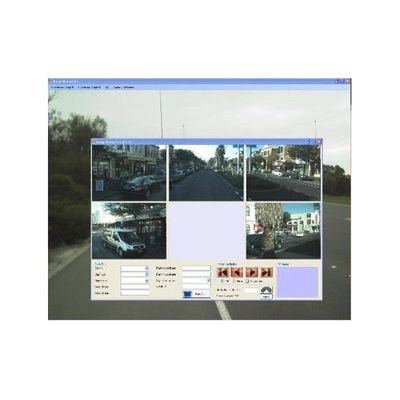
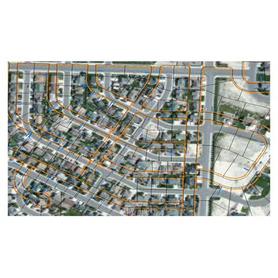
RMSI - Model MapPro - Ready to Deploy, Proprietary Suite of Integrated Tools for End to End Map Data Development Software
RMSI MapPro™ is a workflow driven, matured, end to end suite of production and quality tools for each stage of the map production lifecycle – from input preparation, network data capture, attribute conflation, video data integration, to POI integration. These tools are integrated with the work flow management system and calculate the efficiency at each production step from the system itself. RMSI MapProTM is a highly configurable and customizable solution and its processes can be further customized based on project requirements.
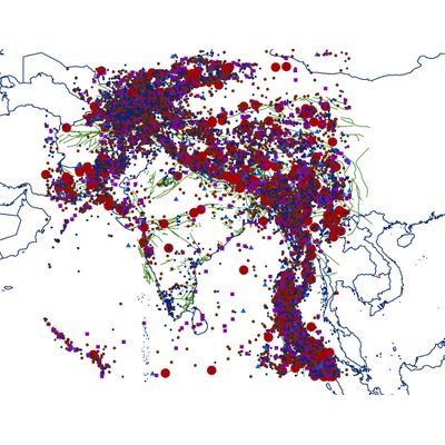
EarthquakeRisk - First High Resolution Earthquake Risk Software
RMSI’s Indian EarthquakeRisk™ is the most up to date high-resolution model that covers the entire Indian sub-continent comprising of India, Pakistan, Nepal, Bhutan, Bangladesh and Sri Lanka. The model derives understanding of earthquake risk for events from 718 AD to the most recent Nepal earthquake. It incorporates the most recent advancements in the area of earthquake engineering along with most up to date hazard and exposure data.
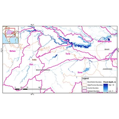
India FloodRisk - Comprehensive Flood Risk Assessment Software
RMSI’s India FloodRisk™ provides comprehensive flood risk assessment for the entire country covering 19,000+ pincodes. India FloodRisk™ is a probabilistic flood risk model for 51 major urban agglomerations with significant flood risk accumulation along with modeled flood risk scores for the rest of the country with medium and low risk accumulation.The model integrates a visual map interface that makes it easy to understand and apply analysis. Probabilisitic flood risk model for 51 urban agglomerations and flood risk scores for rest of the country.
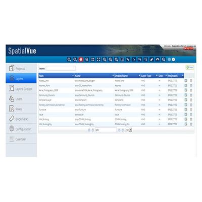
SpatialVue - Enterprise WebGIS Platform
SpatialVue is an enterprise Web GIS platform developed using OGC standards such as WMS, WFS, and WPS. It is compatible with all OGC compliant commercial and open source web mapping engines such as ESRI ArcGIS 9/10, GeoServer, Autodesk MapGuide, Erdas Apollo, MapInfo, and Deegree, amongst others. SpatialVue provides the requisite out of the box tools to publish spatial data quickly and securely over the web with an authenticated security and role based user access. It enables easy and efficient management, visualization, editing, and maintenance of spatial data. It is easily customizable, depending on the user requirements, without having to reprogram and rewrite codes. It is best suited for clients who want to accelerate their WebGIS development and deployment.