
SatFish
3 products found
SatFish products
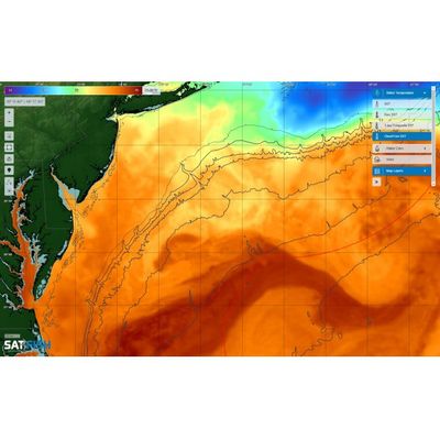
SatFish - Cloud Free SST Charts
Using the latest satellite and software technology, we can now see the surface temperature THROUGH the clouds. Use our Cloud Free Sea Surface Temperature maps to point you in the right direction even when Mother Nature isn’t letting us have a look at the true sea surface temperatures.
SatFish - Chlorophyll Concentration Maps
Chlorophyll concentration maps display the quantity of plankton and other plant life in the surface layer of the ocean.
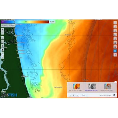
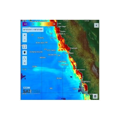
SatFish - Sea Surface Temperature (SST) Maps
Sea surface temperature (SST) maps are made by satellites orbiting the Earth. These images show you where the water temps are right for the species you’re targeting, such as tuna, marlin, mahi, and wahoo. Temperature breaks also mark “edges” that congregate bait fish, kelp, weed lines and sea life.