

Searcher
4 software found
Searcher software
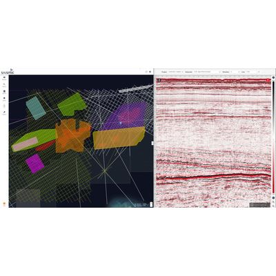
Global Rectified Seismic Data On-Demand
sAIsmic is a web-portal delivering global rectified seismic data with instant viewing and GIS capabilities. sAIsmic allows for instant viewing of seismic data with streaming available from anywhere in the world. sAIsmic is the ultimate scouting tool for exploration teams around the world. With online access to your seismic data, your team can begin exploring in an instant.

Web Portal Product
Seisintel is a web portal product which provides live and historic survey information and vessel usage information for the marine survey industry. Seisintel derives this information from Automated Identification System (AIS) data loads and manual database population of survey and client details. Our primary focus is the marine seismic streamer and marine OBN seismic vessel market.
GeoClerk
Geoclerk Petroleum
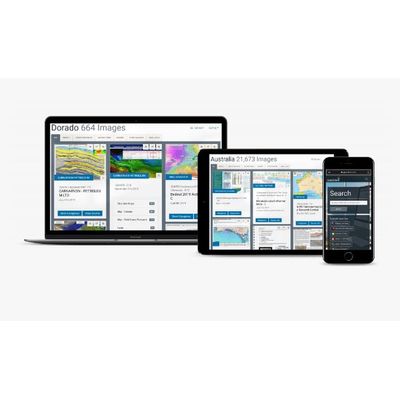
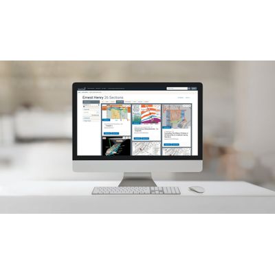
GeoClerk is a web-based platform that utilises machine learning to source industry related imagery and link back to its source documents. GeoClerk unlocks a wealth of valuable, industry relevant information that was previously hidden within and around images in legacy geoscience publications. GeoClerk classifies and extracts imagery and pertinent data from unstructured documents, which is then collated in searchable and filterable geo-imagery libraries for convenient access. A wide range of geoscience images, from maps, geosections, seismic, stratigraphy, structure maps to well logs, are collected and catalogued from websites, presentations, reports, and scanned documents. A limitless library of geoscience images is centralised onto the subscription-based platform, enabling the industry to view all published geoscience imagery in one platform.
Geoclerk Minerals
GeoClerk is a web-based platform that utilises machine learning to source industry related imagery and link back to its source documents. GeoClerk unlocks a wealth of valuable, industry relevant information that was previously hidden within and around images in legacy geoscience publications. GeoClerk classifies and extracts imagery and pertinent data from unstructured documents, which is then collated in searchable and filterable geo-imagery libraries for convenient access. A wide range of geoscience images, from maps, sections, 3d models, lithostratigraphy, geophysics, and photos from thin sections to location shots, are collected and catalogued from websites, presentations, reports, and scanned documents. A limitless library of geoscience images is centralised onto the subscription-based platform, enabling the industry to view all published geoscience imagery in one platform.