

Simcoe Geoscience Limited services
Consulting
Data Integration & Interpretation Services
Interpretation goals are discussed with individual clients. Whether a broad regional interpretation is required, or detailed target delineation on multiple datasets and data types, Simcoe has the experience. Integration of legacy data sets collected either from government sources, service providers, or part of your archives, all of these data can be combined into a common database. Simcoe will compile data and produce products that are developed in cooperation with your exploration team. We firmly believe in working as a team with your company will produce the best results.
Project Design & Modelling Services
Effective design and planning should be based upon a clear definition of target goals. In some cases it is prudent to investigate the theoretical response of anticipated targets in order to properly ensure that the proper specifications for your surveys will maximize the ability of the system(s) to delineate targets in both lateral and depth extent. Simcoe Geoscience can provide expertise in pre-survey planning and target response modelling where needed.
Contract Negotiation Services
Simcoe’s experienced management and technical team are well versed in ensuring that contracts are properly designed. Specifications for geophysical data collection, including reasonable system verification checks are all part of a properly designed contract. We can review and help you to make the right decisions for any geophysical contract.
Quality Control & Assurance Services
Data quality control and assurance is a key factor in any geophysical survey. It is important to collect the best possible data to ensure that targets are able to be detected. Simcoe utilizes the most up to date software to detect noise and other possible data issues on any data set we work with. During collection we can check data daily and verify all tests and final data during mobilization and before demobilization.
Compilation & Visualization Services
Simcoe can work with recently collected data or any legacy data to produce new products with state of the art software. Production of anything from pseudosections, plan maps through 3D presentations of larger data sets is commonly produced. Please contact us for a custom solution.
2D & 3D Inversion Services
Data can be modelled in many ways. Whether 1D, 2D, or 3D modelling or inversions are required in your programs. Simcoe can produce the dataset in a timely and cost efficient manner. We have access to the latest software for all problems, electromagnetic, magnetic, IP, and more. Contacts within the academic community also allow us to keep current on all developments. Please contact us for a custom solution.
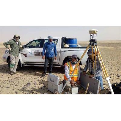
Surveys
Resistivity & Induced Polarization (IP)
The purpose of electrical surveys is to determine the subsurface resistivity distribution by making measurements on the ground surface. From these measurements, the true resistivity of the subsurface can be estimated. The ground resistivity is related to various geological parameters such as the mineral and fluid content, porosity and degree of water saturation in the rock. Electrical resistivity surveys have been used for many decades in hydrogeological, mining and geotechnical investigations. More recently, it has been used for environmental surveys.
Magnetics & Gravity Services
Magnetic surveys measure small, localised variations in the Earth`s magnetic field. The magnetic properties of naturally occurring materials such as magnetic ore bodies and basic igneous rocks allow them to be identified and mapped by magnetic surveys. Strong local magnetic fields or anomalies are also produced by buried steel objects.
Electromagnetics Services
Electromagnetic method is a geophysical technique based on physical principles of the inducing and detecting electrical current flow within geological strata. A primary alternating electric current of known frequency and magnitude is passed through a sending coil creating a primary magnetic field in the space surrounding the coil, including underground. The eddy currents generated in the ground in turn induce a secondary current in underground conductors which results in an alternating secondary magnetic field, that is sensed by the receiving coil. The secondary field is distinguished from the primary field by a phase lag. The ratio of the magnitudes of the primary and secondary currents is proportional to the terrain conductivity.
Geoscience IT
Software Development Services
Simcoe IT Limited offers custom software development services for a wide range of industries. Our dedicated team is professional and has the right mix of practical knowledge and technical expertise to create software solutions that are flexible, reliable, scalable, and at the same time cost-effective.