

- Home
- Companies
- Spatial Wave, Inc.
- Software
Spatial Wave, Inc. software
The MAMS Suite

Spatial Wave - Model MAMS Professional - Mobile Asset Management Systems
An End-To-End CMMS Solution that grows with your Business. Whether you’re a water or sewer utility or a municipality providing maintenance to city streets, transportation, parks, storm drains and highways, each agency is faced with optimizing the performance of its distributed assets and to maximize their return on investment. This requires implementing the best system available while using technology that is easily adoptable.

Spatial Wave - Model MAMS Enterprise - Mobile Asset Management Systems
An End-To-End CMMS Solution that grows with your Business. MAMS Enterprise Solution is a combination of Spatial Wave’s MAMS Professional Tools and Maximo®, IBM® ’s asset management system to meet all of your asset management requirements. While Maximo® stands for the central point of controlling and enabling you to extend the life of your asset, the addition of SW-MAMS tools will extend these functionalities through adding spatial and mobile support.
Individual Products
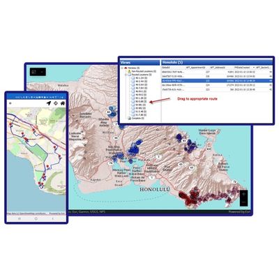
SANStar - Map Based Solution for Desktop and Mobile Platform
A map based solution for desktop and mobile platforms helping Cities optimize the scheduling and pickup of bulky item collection & container replacements. SANStar is Spatial Wave’s GIS-centric cloud solution for the fulfillment of solid waste resources requests. It leverages built-in smart Dispatching, Routing, Mapping and Reporting modules, and can seamlessly connect to various 311 Services.
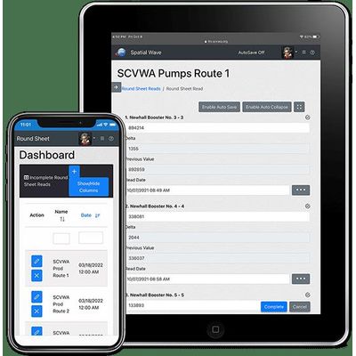
Spatial Wave - Model Roundsheet - Versatile Solution for Collecting Plant Data
Roundsheet is an intelligent tool that simplifies the periodic data log and inspection data collection by the operators of one or more facilities. Roundsheet saves time and effort for a supervisor to manage creation, assignment, and monitoring of field data collection and inspections by his or her field crews. Many organizations typically refer to this need as “daily logs”, “monthly logs”, “inspection logs”, “logbook,” etc.

Spatial Wave - Model Field Mapplet - Field-Work Software
An advanced solution for GIS-enabled mobile computing that can be used for all types of field work. Specially designed to automate any workflow that spans both office and field, including departments such as Customer Service, Field Operations, Engineering and Finance departments.
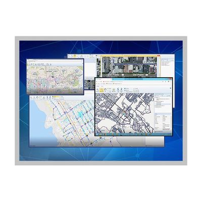
Spatial Wave - Model Mapplet - Geographic Information System Viewer
Spatial Wave’s flagship Geographic Information System Viewer. Mapplet allows your enterprise to leverage its investment in Geographic Information System (GIS) Data. Mapplet allows users access to location aware maps, multi-form tabular data, and other drawings and documents. All departments including Customer Service, Field Operations, Engineering and Finance departments can use this highly innovative map-based viewer to fully utilize their GIS program.
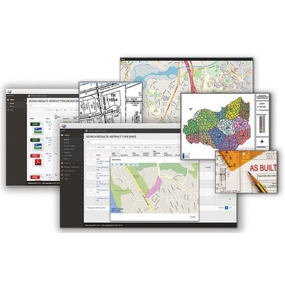
MapLibrary - Web-Based Application for the Distribution and Sharing of Thematic Maps
Provides easy access & sharing of electronic documents. MapLibrary is a web-based application for the distribution and sharing of thematic maps, as-built drawings, and other types of electronic documents. Requiring little technical proficiency, MapLibrary makes data access easy and expands the audience within your organization who can benefit from their investment in GIS. MapLibrary includes a web-based administrator interface for customizing the metadata stored with the documents, constructing pre-defined searches, and configuring user profiles if maps or documents need to be approved prior to being made available for retrieval.
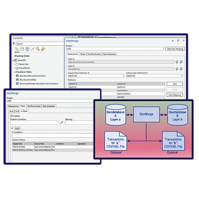
GeoMerge - Rule-Based GIS Data Merging Tool
GeoMerge is a robust, yet simple, and most of all, reliable software for ensuring that your data synchronizations are done accurately and quickly. GeoMerge is an add-in to ArcGIS Pro programmatically synchronizing two layers/tables using rule-based instructions. GeoMerge uses the user-defined rules when synchronizing the data to resolve the conflicts. This allows for a flexible configuration so the end-user can identify the conditions under which a record is updated, inserted, or removed from the destination.