

- Home
- Companies
- YellowScan
- Products
YellowScan products
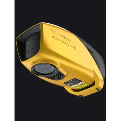
YellowScan Navigator - Bathymetric LiDAR System for Aerial Surveys
The YellowScan Bathymetric LiDAR system is designed for aerial deployment on UAVs, providing in-depth analysis of underwater and land topography through a streamlined, single-button operation. This system employs a class 3B laser scanner developed in-house, optimized for seamless underwater data collection, ideal for topographic continuity in various terrains. Its compact design ensures compatibility with a wide range of UAV platforms, and it includes advanced software features for data processing. The LiDAR system supports applications like coastal mapping, underwater archaeology, and hydrology studies, utilizing a green laser to maximize depth penetration while maintaining safety protocols. Essential components such as high-density laser goggles and a GNSS antenna enhance operational capability. The system integrates with YellowScan's CloudStation software to automate water classification for precise mapping, ensuring data accuracy via underwater point correction and a built-in global shutter camera for imagery fusion.
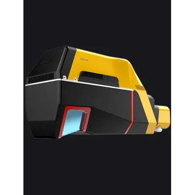
YellowScan Voyager - Advanced LiDAR System for High-Density 3D Mapping
YellowScan's Voyager is a premium LiDAR solution engineered to meet the demands of projects necessitating exceptional point density. The system features a 100° laser scanner capable of acquiring data at rates up to 2400 kHz, allowing for superior mapping accuracy. It is particularly advantageous for missions involving complex terrains, benefiting from an ability to detect up to 32 target echoes per laser pulse, thus enhancing vegetation penetration. The system supports vertical and complex target mapping, offering precision under 1 cm. Adaptable across various platforms such as light-crewed aircraft, helicopters, and UAVs, the Voyager optimizes productivity with its compatibility with optional RGB camera modules. Weighing 3.5 kg, excluding battery, it boasts a maximum flying height of 440 m and a custom-fit laser scanner to suit specific mission requirements. This ensures efficient data collection and processing, making it ideal for industries like forestry, emergency response, and conservation. It includes CloudStation software for seamless data handling and technical support for enhanced user confidence.