
CO.L.MAR. S.r.l.
- Home
- Companies
- CO.L.MAR. S.r.l.
- Products
- CO-L-MAR - Seafloor Mapping and ...
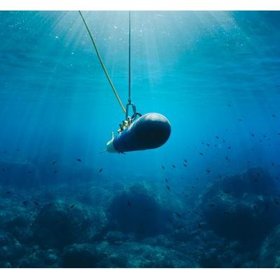
CO-L-MAR - Seafloor Mapping and Classification Vessel
FromCO.L.MAR. S.r.l.
These surveys are carried out every time is requested to know in details the seafloor morphology and habitats:
Most popular related searches
side scan sonar
seabed imaging
seafloor mapping
seafloor
geophysics monitoring
scanning sonar
dual frequency side scan sonar
harbor monitoring
seafloor classification
dredge
- Inside harbors to check minimum draft, for dredging estimation or as preliminary survey;
- Outside the port to monitor erosion phenomena, sensitive habitats or to observe the effect of a beach nourishment;
- In open water as preliminary survey for marine constructions (wind farms, oil and gas facilities, pipe and cable laying).
- Fast and accurate methodologies can provide a seabed image of wide areas with the full coverage.
- Dual frequencies (100-500 kHz) side scan sonar
- Acoustic backscattering from high frequency multibeam system
- Real time mosaicing
- Fast data playback for quality assessment