- Home
- Companies
- Radiodetection Ltd - an SPX Corporation ...
- Products
- Radiodetection - Model RD Map+ - ...
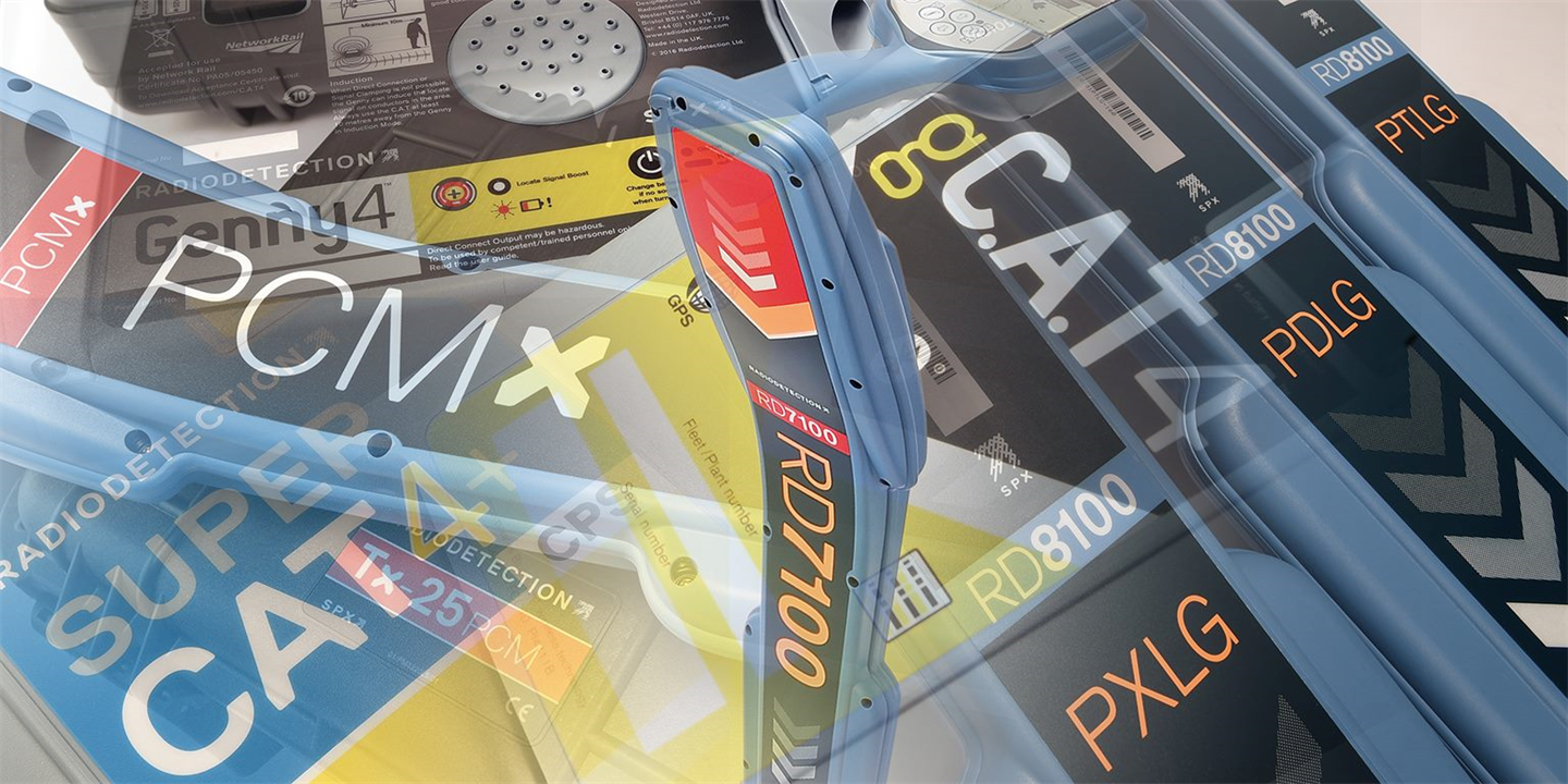
Radiodetection - Model RD Map+ -Mapping and Precision Locating System
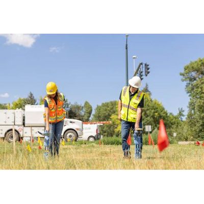
Locate and map buried utilities in a single operation with RD Map™+ and your Radiodetection Precision Locator. RD Map+ is the Map&Share™ Android app for Radiodetection`s Precision Locators which integrates with the Trimble® Catalyst™ GNSS System to deliver Survey Grade position accuracy to locate operations and to allow locator technicians to create detailed maps of the buried utilities.
Flexibility is at the heart of our mapping solutions, allowing customers to choose the solution that is most suitable for their business. We offer turnkey solutions for those new to the world of utility mapping, while utility mapping experts can connect into their advanced systems.
RD Map+ support and training material can be found in our online learning zone.
RD Map+ is free to download and use from the Google Play store. A Premium license is required to create Survey-Grade digital maps.
Google Play and the Google Play logo are trademarks of Google LLC.
Compatible with the RD8200® locators, RD7100® RF marker and all RD8100® locators.
Built in integration of the Catalyst™ DA2 GNSS system which delivers high accuracy position measurements via satellite and without requiring an active data connection.
Set up your required vertical and/or horizontal job accuracy to use the built in traffic light accuracy indicator system which turns green when you are ready to go.
RD Map+ has a built in comprehensive manual and videos library to help you get the most of your system. Ask technical questions directly from within the app.
Create and share job files that includes multiple utilities, with path and icons which supports standard coded colors (Premium license required).
- Upgrade bundle
- Simple to use - Everywhere
- Integrates to existing locating workflows
- Google Maps interface