
Oldbaum Services Limited
Oldbaum - LiDAR Remote Sensing Tool
LiDAR (Light detecting and ranging) is a remote sensing tool now widely used and accepted in the wind industry by users and financial institutions.
Most popular related searches
remote sensing system
remote sensing
LiDAR remote sensing
LiDAR
LiDAR scanning
LiDAR detection
LiDAR system
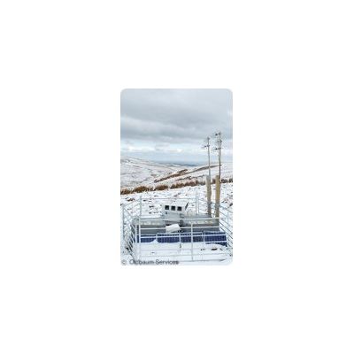
LiDAR comes in many iterations including ground based LiDAR, Floating LiDAR, Nacelle LiDAR, and Scanning LiDAR. Oldbaum are experts in all these LiDAR forms and are able to provide technical advice on the right solution for your project needs.
With services ranging from model validation and resource assessment, through to wake and complex flow studies, and power curve validation, Oldbaum are able to provide tailored data services dependent on the project requirement.
Get in touch to arrange a demonstration, and to discuss the outstanding performance and technology embodied in these class leading instruments.
Members of the WindCUBE Wind Experts Programme.
Members of the Natural Power Trusted Service Provider Programme.
LiDAR sales & services
Oldbaum Services are acknowledged experts in both pulsed and continuous wave technologies, having operated systems in both commercial and research projects.
Whether you are looking for turbine mounted data acquisition, site prospecting, noise evaluation studies, or power performance assessment, Oldbaum are able to offer independent expertise on the best solution for your project.
LiDAR rentals
Oldbaum have a number of systems available for rental. Based on a minimum contract of 4 weeks, we would be happy to discuss your project and data requirements to see which solution best suits you.