

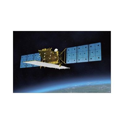
Model ALOS-2 -Satellite Sensor
ALOS-2 is the follow-on JAXA L-SAR satellite mission of ALOS (Daichi) approved by the Japanese government in late 2008. The overall objective is to provide data continuity to be used for cartography, regional observation, disaster monitoring, and environmental monitoring.The post-ALOS program of JAXA has the goal to continue the ALOS (nicknamed Daichi) data utilization - consisting of ALOS-2 (SAR satellite) and ALOS-3 (optical satellite) in accordance with Japan`s new space program.
ALOS Satellite Sensor (2.5m)
ALOS (Advanced Land Observation Satellite) has been decommissioned. ALOS was successfully launched on January 24, 2006 from the Tanegashima Space Center.
ALOS Satellite Sensor (2.5m)
The ALOS (renamed "Daichi") satellite sensor had three remote-sensing instruments: the Panchromatic Remote-sensing Instrument for Stereo Mapping (PRISM) and for digital elevation models (DEMs). The Advanced Visible and Near Infrared Radiometer type 2 (AVNIR-2) for precise land coverage observation, and the Phased Array type L-band Synthetic Aperture Radar (PALSAR) for day-and-night and all-weather land observation and enabled precise land coverage observation and can collect enough data by itself for mapping on a scale of 25,000:1, without relying on points of reference on the ground. Some of its objectives where cartography, disaster monitoring, natural resource surveys and technology development.
In April 2011, the satellite was found to have switched itself into power-saving mode due to deterioration of its solar arrays. Technicians could no longer confirm that any power was being generated. It was suggested that metiorides may have struck ALOS, creating the anomaly which eventually led to its shutdown.
On 12 May 2011, JAXA sent a command to the satellite to power down its batteries and declared it dead in orbit.
The ALOS AVNIR-2 and PRISM Imagery and PALSAR data is available from the exiting archives.
Resolution: 2.5m panchromatic
10m multispectral
Launch Vehicle: H-IIA Rocket
Launch Site: Tanegashima Space Center
Satellite Weight: Approximately 4,000kg (at Lift-off)
Power: Approximately 7,000W (End of Life)
Designed Life: 3 to 5 years
Orbit: Sun Synchronous Sub-Recurrent Orbit
Recurrent Period: 46 days
Sub cycle: 2 days
Altitude: Approximately 692km (above the equator)
Inclination: Approximately 98.2 degrees