

CO.L.MAR. S.r.l.
- Home
- Companies
- CO.L.MAR. S.r.l.
- Products
- CO-L-MAR - Shore and Coastline ...
CO-L-MAR - Shore and Coastline Topography Scan Sonar
FromCO.L.MAR. S.r.l.
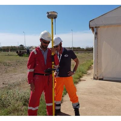
The Shore and coastline survey along with bathymetric studies are the means to observe the beach evolution and the interactions between the land and the sea. The analysis of the coast modification is the basis for researches about erosion phenomena and beaches nourishing due to natural or anthropogenic actions. This kind of survey along with bathymetric studies are the means to observe the beach evolution.
Most popular related searches
Thanks to the high precision of the Global Navigation Satellite System and the specific software for data processing (CAD and GIS), the coast can be surveyed and mapped in 3D cartographic or digital format with very high accuracy.
- Coastal monitoring, beach nourishment, laying cables and pipelines.