

- Home
- Companies
- Guideline Geo
- Products
- ABEM- WalkTEM - Transient ...
ABEM- WalkTEM - Transient Electromagnetic System
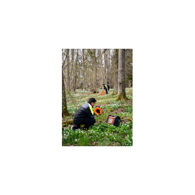
ABEM WalkTEM offers fast, efficient penetration of conductive overburden with excellent data collection in high resistivity zones. The Transient Electro-Magnetic (TEM) method offers good penetration of conductive overburden and is increasingly popular for hydrogeological purposes as well as general geological mapping and mineral exploration. Since there is no requirement for galvanic ground contact, data can be collected in high resistivity surficial zones and in areas covered by ice or exposed rock.
ABEM WalkTEM is derived from the airborne SkyTEM helicopter system, sharing the technology. While SkyTEM covers large areas, ABEM WalkTEM offers more accurate resolution of fine details in geology. With a set of predesigned protocols, ABEM WalkTEM quickly switches between different tasks. A variety of transmitter loop sizes provides good scalability for the project at hand.
A high level of integration means less carrying and setup. Data collection is complete in a few minutes. Powerful on-board processing software takes the guessing out of field surveys as a resistivity layer model can be produced within a minute after a measurement has been conducted.
- Easy to handle standalone system
- Fast setup, field effective operation and processing directly on site
- Dual moment measuring technique enables high resolution data from both large and shallow depths
- Intuitive graphical user interface, easy to switch between pre-installed protocols, integrated easy-to-use processing software
- Groundwater prospecting
- Geological mapping
- Salinity studies
- Mineral exploration
- Built-in computer and integrated GPS
- Dual moment operation
- Sunlight visible LCD with graphical user interface
- A variety of transmitter loop sizes are available
- High level of integration – a rapid turn-off transmitter, dual channel receiver and computer in one rugged and portable platform
- Dual channel input utilizes dual antennas working simultaneously
- On-board data processing software
- ViewTEM processing software is offered as a powerful option for further data editing and processing in the office.
- Fully compatible with Aarhus Workbench for further visualization
GENERAL
- Casing: Rugged Aluminum case meets IEC IP66
- GPS receiver: 50 channels SirFstarIII chip
- Display: 8,4” Active TFT LCD, full color, daylight visible, with 6 mm shatterproof glass, resolution of 800×600
- I / O ports: 2x KPT-19 for receiver coils
- Power: 2x 12 V, 8 Ah internal NiMH power pack, 10-34 VDC external power
- Battery chargers: Integrated for internal batteries
- Dimensions(WxLxH): 390x210x320 mm
- Weight:14 kg
- Ambient Temperature Range: -20 °C to +60 °C operating, -30 °C to +70 °C storage
INTEGRATED FIELD PC
- Processor: Low power Intel Atom,1,6 GHz
- Operating System: Windows XP Pro
- Internal RAM: 2 GB (DDR SO-DIMM module)
- Hard disk capacity: Solid state disk of 100 GB or greater
- I / O port: 2x USB 2.0 ports
- Network interfaces: 1x IEEE 802.3, TP-10/100/1000, RJ-45 IP67
- WiFi interface: Integrated with built-in antenna
TRANSMITTER
- Output current: 15 A
- On/Off Time: Adjustable from 1 ms to 500 ms in microsecond steps
RECEIVER
- Receiver input: 2 Channels
- Sampling: 1 MHz each channel
- Dynamic range: 170 dB system 140 dB instantaneously
- Repetition rate: From 500 Hz to 0.5 Hz in microsecond steps
- Stacking options: 1 to 65,536 in single steps
- Windows (Gates): Up to 200 depending on time series selected in 3 sets (optional, user selectable)
- Functions measured: Transient response, current battery voltage (external an internal), automatic gain/offset calibration, layer model (full data inversion)