

- Home
- Companies
- Guideline Geo
- Products
Guideline Geo products
ABEM Geophysical Solutions
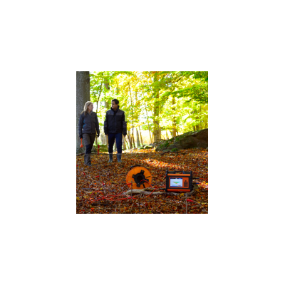
ABEM - Model LS - Commercial Resistivity Meters
Taking Resistivity/IP surveying to greater depths with higher resolution Engineered to fit most applications and customizable to suit all. Data acquisition to client deliverables, the ABEM Terrameter LS offers support at every step in your survey project. Through innovations in the core technology, ABEM has developed a Resistivity/IP solution that addresses the challenges of data acquisition in the field and empowers the user with highly efficient interpretation tools – guaranteeing increased productivity and quality. The out-of-the-box configuration provides a solution for most projects and can be easily customized to meet specific project requirements.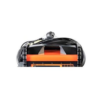
ABEM- Terraloc - Model Pro - Versatile Seismograph Meter
The ABEM Terraloc Pro is a versatile seismograph that can be used with any type of seismic accessory for every possible application. Typical applications are depth to bedrock, bedrock quality, soil stability studies, finding fractures and weak zones, and geological mapping. In all these applications the seismograph is triggered by ground vibrations created by an energy source. Time is then measured accurately until the ground vibrations have propagated through the ground and can be measured by geophones connected to the seismograph.
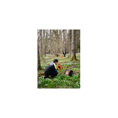
ABEM- WalkTEM - Transient Electromagnetic System
ABEM WalkTEM offers fast, efficient penetration of conductive overburden with excellent data collection in high resistivity zones. The Transient Electro-Magnetic (TEM) method offers good penetration of conductive overburden and is increasingly popular for hydrogeological purposes as well as general geological mapping and mineral exploration. Since there is no requirement for galvanic ground contact, data can be collected in high resistivity surficial zones and in areas covered by ice or exposed rock.
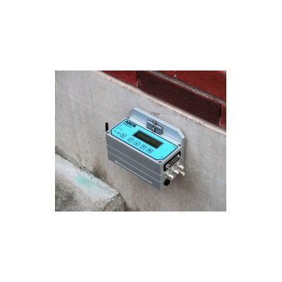
ABEM VIBRALOC - Vibration Monitor
Optimized for monitoring of blasting and construction work, ABEM Vibraloc is packed with features for vibration monitoring, yet easy to use – you can be up-and-running with a few button clicks.
MALÅ
MALÅ Easy - Model HDR - Locator
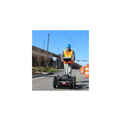
The easy-to-use, industry-leading GPR solution for utility location and detection. MALÅ Easy Locator HDR (EL HDR) builds on its industry-leading reputation for speed, ease-of-use and data delivery. It is the standard tool of choice for locating buried infrastructure. MALÅ EL HDR offers one of the most cost-effective ways of obtaining precise and reliable information about the location and depth of buried objects such as pipes, cables and other utilities. In its latest form, the unit is faster, more powerful and even easier to use, thanks to a simplified user interface. The all-in-one unit is ruggedly constructed and easy to transport. No other GPR technology offers this level of capability and data clarity at such competitive price levels.
MALÅ Easy - Model EL Pro - Locator
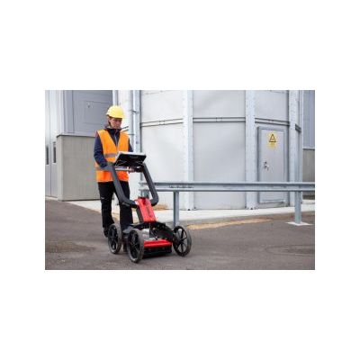
The professional’s choice for utility mapping. MALÅ Easy Locator Pro (EL Pro) is a cost-effective GPR solution that provides a comprehensive, end-to-end choice for utility mapping. It is the third generation of the EL-series.
MALÅ - Model CX - Concrete Explorer GPR System
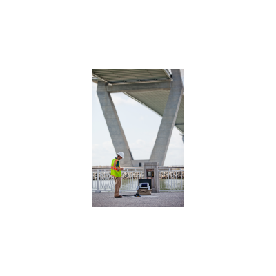
MALÅ ConcreteExplorer (CX) is an easy-to-use, GPR system designed for the non-destructive investigation and imaging of concrete and other man-made structures.
MALÅ - Model GX - Ground Explorer GPR System
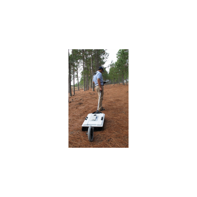
MALÅ GroundExplorer (GX) is based on innovative, patent-pending MALÅ High Dynamic Range (HDR) technology and represents a leap forward in GPR. MALÅ GX is an integrated GPR solution with four MALÅ GX antenna options: GX80, GX160, GX450 and GX750. Built around a fast 1.6 GHz Intel Atom processor and using a high-resolution display to present the 32-bit data. The MALÅ GX Controller delivers excellent performance and outdoor visibility. The easy-to-use controller has a built-in battery to simplify handling in the field. MALÅ GX antennas feature an integrated DGPS for accurate positioning and the solution supports the use of external GPS. MALÅ GX solutions support a wide range of distance measuring encoders. The new WiFi option enables wireless data collection, making it even easier to use in less accessible areas. The controller can be separated from the antenna by up to 50 meters.
MALÅ - Model ProEx - Control Unit
Designed on a modular platform, MALÅ ProfessionalExplorer (ProEx) is the most versatile control unit in the MALÅ range and replaces the world famous RAMAC/GPR CUII.

MALÅ MIRA - 3D Ground Penetrating Radar (GPR) System
The most technically advanced 3D ground penetrating radar (GPR) system on the market. MALÅ Imaging Radar Array (MIRA) is a one-pass 3D system providing a cost-effective solution for large scale mapping and subsurface object identification. It is the only system of its kind that seamlessly integrates acquisition, processing, QA/QC, positioning data, interpretation and export of ground penetrating radar data.