- Home
- Companies
- GeoView, Inc.
- Services
- Bathymetric Profiling Services
Bathymetric Profiling Services
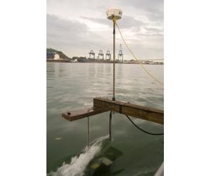
The basic principle behind bathymetry is the use of acoustic waves (in the range 30 to 250kHz) to measure the water depth. A complete bathymetry system includes a vessel, an echo-sounder (analogue or digital) and a positioning system (DGPS or RTK). The depth information is geo-referenced in real time and recorded on a portable computer on-board the boat.
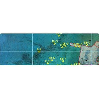
Single beam systems are used for small, shallow water surveys with difficult access. Swath (or multi-beam) surveys are used for surveying large areas, such as ports, waterways, lakes and at sea. Swath systems are capable of attaining 100% coverage of the bottom, over a width of 5 to 10 times water depth, and hence are more cost effective for large areas.
Typical uses for bathymetry are:
-
Production of Digital Terrain Models (DTM) of the bottom for engineering design (tunnels, pipelines, bridges);
-
Hydrographic surveys for navigational safety;
-
Dredging control
-
Geotechnical studies.