
- Home
- Companies
- GeoView, Inc.
- Services
GeoView, Inc. services
Land Based Services

Archaeological Services
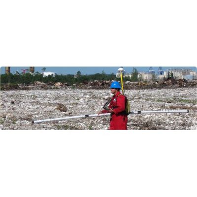
The use of geophysics has become increasingly beneficial to archaeological surveys. A geophysical survey should not be used to replace an in-depth archeological survey conducted by a qualified professional archaeologist. Instead, it should be used as one of many tools that can be applied to the investigation. Geophysics can be used to provide either a general site overview or a higher resolution image of a particular area of interest. This data helps direct future excavation efforts and additional archaeological work.
Borehole Geophysics Services
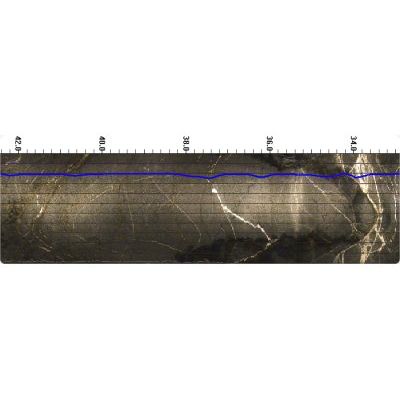
Borehole geophysics can provide precise information regarding the soil and rock properties at specific depths.
Cell Tower Foundation Mapping Services
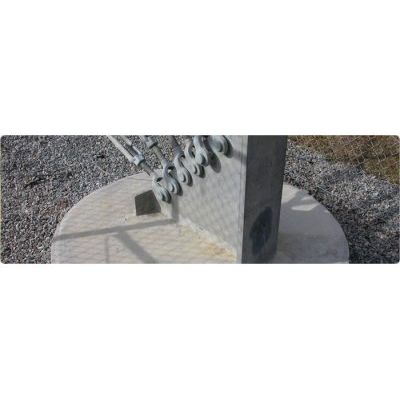
The determination of the three-dimensional design of foundations for telecommunications towers, buildings and signs can be nearly impossible using conventional means. Properly applied geophysical test methods, probing and shallow test pits provide a very cost-effective and non-destructive approach to determining the foundation design. GeoView has conducted literally 1,000’s of investigations evaluating buried foundations for telecommunication towers across the United States. Monopoles, self-support and guy-wire anchor foundation systems have been studied in both urban and remote rural settings. Many building and bill-board sign foundations have also been evaluated.
Environmental Studies Services
Geophysics has been successfully applied to environmental investigations for many decades and has become even more accurate and cost effective with the integration of global positioning systems and more advanced computer modeling.
Geotechnical Characterization Studies Services
Geophysics should be an integral part of any geotechnical site characterization study. GeoView has performed thousands of geophysical surveys as part of geotechnical characterization studies. The projects are managed by licensed professional geologists who have the tools and the knowledge to bring the appropriate method to each job. The following are common applications of geophysics in these studies.
Hydrogeological Characterization Studies Services
Hydrogeological characterization studies cover a broad range of applications and services. In the broadest sense these studies are designed to characterize either the earth matrix which is controlling groundwater flow or the quality of the ground water.
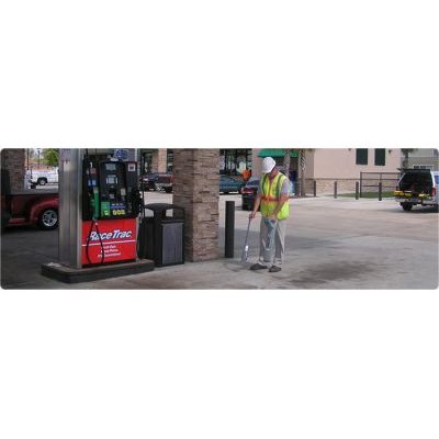
Infrastructure Studies Services
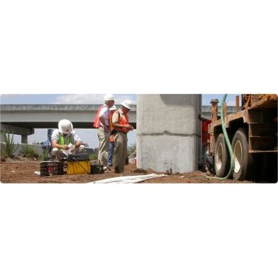
Geophysics is an important forensic tool in a wide range of infrastructure related studies. The non-destructive tests (NDT) enable the engineer or geophysicist to inspect the interior of a structure without the need to physically dig, drill or otherwise destroy part of the structure. GeoView has performed thousands of infrastructure related studies for both governmental agencies and private contractors throughout the United States and the Caribbean.
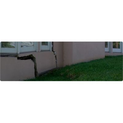
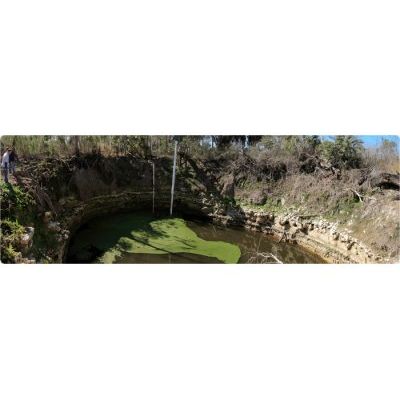
Residential/Commercial Sinkhole Studies Services
The investigation of potential karst (sinkhole) activity at residential or commercial properties or undeveloped land is a multi-disciplinary process in which geophysics plays a critical role. Subsurface geology in karst environments is very complex and is often masked at the surface. Properly selected and applied geophysical tools will provide a 2 or 3 dimensional perspective of subsurface geological conditions in these settings.
Utility Designation Services
The American Society of Civil Engineers (ASCE) has developed a standard of care guideline, which describes four quality levels of utility depiction.