
- Home
- Companies
- ASI Group Ltd.
- Services
- Hydrographic Mapping Surveys
Hydrographic Mapping Surveys
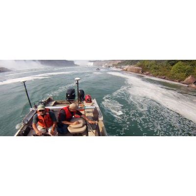
ASI’s hydrographic mapping services provide clients with a thorough underwater investigation of the conditions of rivers, estuaries, channels, lakes, harbour bottom surfaces and submerged infrastructure. A combination of geophysical mapping equipment and the latest charting technology enables us to locate and assess any submerged surface features and targets addressed by our clients. The findings are measured and mapped with precision accuracy in real-time.
ASI’s underwater mapping services include:
Multi-beam Bathymetry
- 100% bottom coverage
- High precision bathymetric data
- Ideal for large areas
- Compensation for vessel pitch, roll and heave
- Image mapping
Single-beam Bathymetry
- Highly accurate water depth and bottom contours
- Low cost
- Highly portable enabling expedited mobilization
- Easily deployed on small boats/ships
Side Scan Sonar
- Industry standard technique for image mapping
- Provides excellent target detection, bottom classification
- Highly accurate
- Used to delineate very small targets and bottom features
- High or low resolution options
ASI’s in-house certified hydrographers, cartographers and graphic specialists produce detailed technical reports (hardcopy and GIS compatible formats) utilizing geophysical data acquired during the underwater investigations. Each report is produced to help clients make informed decisions.