

Radar
Ground penetrating radar is the most effective non-intrusive method for detailed mapping, detection and imaging of shallow subsurface and for inspecting various structures` interiors. The radar enables to carry out measurements on almost any type of surface such as soil, rock, fresh water, air or concrete; it also allows performing measurements in boreholes, conducting cross borehole tomographic measurements, and 2D and 3D measurements. Data acquisition in the field is fast, detailed and at the highest resolution attainable.
The ground penetrating radar system is based on the transmission of electromagnetic waves into a medium (soil, concrete), and recording the reflected waves on the surface. The method is sensitive to changes in the electrical properties of the subsurface (i.e., to the dielectric constant and the electrical conductivity). The electrical properties of the subsurface depend on its type and structure, as well as on its water content. When the dielectric properties of different materials contrast, some of the electromagnetic energy is reflected. The amplitude and the travel time of the reflected waves are recorded in order to map the subsurface.
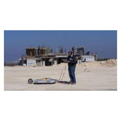
The electromagnetic waves are transmitted by an antenna at the defined central frequency, and are received by the same antenna (a monostatic system), or alternatively by a separate antenna (bistatic system). The transmitted frequency is determined in accordance with the dimensions and depth of the target. The depth and the frequency are inversely proportional, so that the lower the transmission frequency – the greater the depth of penetration and the lower resolution, and vice versa: transmission at higher frequencies produces an image of a shallower part of the subsurface (however, at a high resolution). The characteristic frequencies of ground penetrating radar range from 25 MHz to 2.5 GHz. Fig. 1 below presents an example of the difference in penetration depth of 250 MHz and 100 MHz antennas in the sand dunes of Rishon Le-Zion.
Upon completion of the radar survey, a series of cross-sections of the subsurface is received (corresponding to a seismic section), which are displayed in terms of time vs. lateral distance. The time refers to the wave`s travel time in the ground, to and from the target (TWTT). The radar wave`s velocity in the air is approximately the speed of light (0.2998 meter/nanosecond), however its velocity is diminished when traveling through other mediums (the slowest is the propagation velocity of the electromagnetic waves in water). The propagation velocity of the electromagnetic wave through the medium is dependent on the subsurface`s electrical properties.
- The highest resolution, in comparison with all other geophysical methods
- Silent, non-intrusive survey
- Relatively quick coverage of large areas
- Quick data interpretation
- Wide range of applications
- Slow data acquisition in uneven field conditions
- The penetration depth is limited in media having a high conductivity (such as clay)