
Geotec Engineering & Environmental Geophysics Ltd services
Borehole scanning
Explorer 2000 is a unique photography system that enables to locate, map, examine, scan and measure boreholes and voids. This is a digital video recording system combined with a laser range finder, developed specifically for inspecting the bottom and sidewalls of boreholes, and assessing the volume of subsurface cavities. It is ideal for all applications requiring high resolution color photography of the borehole and its sidewalls.
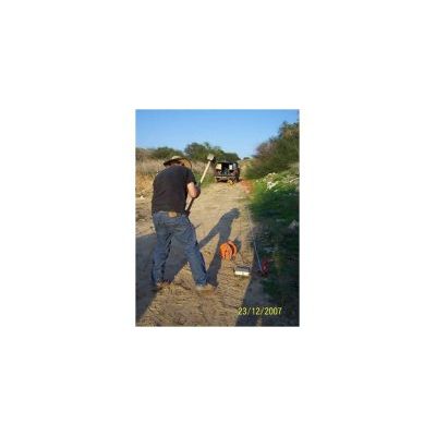
Sismic surveys
A seismic survey is based on an energy source that excites seismic (elastic) waves in the subsurface. The seismic waves propagate in the subsurface and are reflected or refracted in the interfaces between mediums, having a different seismic velocity. The reflected and refracted waves are recorded on the surface by an array of receivers (geophones). The recorded travel times between the source and the geophones, and the geometry of the geophones and the source, enable to obtain information that is processed and interpreted, providing an image of the subsurface.
Geoelectrical surveys
The measurement of electrical resistivity of the subsurface is one of the oldest geophysical methods (VES). It was developed during the late 1980s and the early 1990s as an electrical 2D and 3D imaging method for mapping the resistivity distribution in the subsurface CVES/ERT. Electrical resistivity is effective for shallow subsurface mapping at a good resolution. Its clear advantage is in its indifference to electromagnetic noise produced in the urban environment.
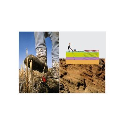
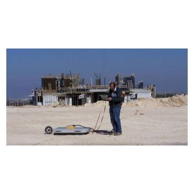
Electromagnetic Surveys
Electromagnetic methods (FDEM, TDEM) were developed for the purpose of measuring resistivity in the subsurface. The methods are used extensively around the world to provide solutions to engineering and environmental problems. These methods, which enable penetration to relatively great depths (up to hundreds of meters), allow to carry out deep measurements at a very high level of accuracy. In Israel, electromagnetic methods are mainly used for monitoring changes in groundwater salinity and for locating metals objects. The electromagnetic equipment used is mobile and easy to operate, and the measurements can be relatively quickly analyzed and interpreted.
Geophysical Consultancy
Geotec Engineering & Environmental Geophysics Ltd is a team composed of multidisciplinary and highly skilled experts, in engineering and environmental geophysics. Geotec offers consulting services over a wide range of geophysical methods and applications in engineering and the environment: Design, Data acquisition in the field, Data and signal processing, Interpretation, Our multidisciplinary team of experts will provide the client with the best solutions.
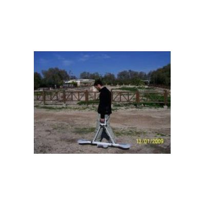
Ground Penetrating Radar
Radar
Ground penetrating radar is the most effective non-intrusive method for detailed mapping, detection and imaging of shallow subsurface and for inspecting various structures` interiors. The radar enables to carry out measurements on almost any type of surface such as soil, rock, fresh water, air or concrete; it also allows performing measurements in boreholes, conducting cross borehole tomographic measurements, and 2D and 3D measurements. Data acquisition in the field is fast, detailed and at the highest resolution attainable.
Vibration monitoring
Vibration
Geotec offers various measurement services of ground vibrations and air blast, caused by blasts, heavy duty construction equipment and other sources. The purpose of the measurements is to prevent damage to structures and discomfort to people. Additionally, vibration measurements enable contractors to plan their activities on the basis of accurate scientific information and maximize the efficiency of their work under given conditions.