

- Home
- Companies
- Bluesky International Ltd.
- Software
- 3D Building Models Software
3D Building Models Software
Bluesky has direct access to the largest collection of high resolution stereo aerial photography in the UK, and we are therefore ideally placed to provide cost-effective, accurate and detailed 3D models of the urban environment, using advanced photogrammetric techniques.
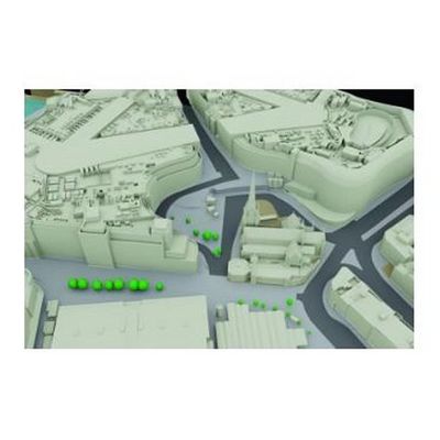
Bluesky’s 3D building models provide a detailed visual representation of the built environment, allowing interaction, analysis and interrogation of our urban landscapes on an unprecedented level. The data can be provided at a variety of levels of detail and are tailored to your own specifications. All models include a detailed terrain model.
Derived photogrammetrically from our high resolution stereo aerial photography, our 3D building models are geographically accurate and specifically designed to support developers, architects and urban planners in making efficient, cost-effective and informed decisions about the urban environment.
New technology and advances in image processing allow automated, fully rendered 3D models of entire cities at a fraction of the cost that they were in the past.
- 3D building and City models for CAD & GIS
- LOD1, LOD2 & LOD3 as standard
- LOD4 as specialist projects
- Wireframe or block models
- DWG format as standard
- Other formats available
- OSGB Projection
- Modelling and Simulation
- Urban and Master Planning
- Shading and Viewshed analysis
- Architecture
- Security and Counter Terrorism
- Power Lines and Utilities
- Transport
- Flood Modelling
- Transport
- Renewable energy
- National coverage
- Flexible Licensing
- Connectivity & Interoperability
- CAD Ready
- Compatible with Ordnance Survey products