

Bluesky International Ltd. software

Aerial Photography Software
Aerial photography continues to play a vital role across a variety of disciplines, whether it be environmental management, policy implementation, planning, enforcement, or network analysis. Now more than ever it is part of everyday life through online mapping portals, and extensive use in both printed and digital media.
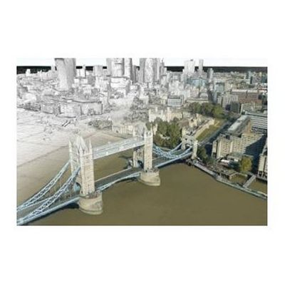
Bluesky Leica - Model MetroVista - CityMapper Software
The CityMapper from Leica has enabled Bluesky to capture several UK cities in a way that has never been achieved before. The Leica CityMapper is the world’s first hybrid airborne sensor combining oblique and nadir imaging as well as a LiDAR system into one sensor. Bringing together the best of both worlds, the CityMapper is specifically designed for urban mapping. Combined with the high-performance post-processing workflow, it offers a complete 3D urban mapping solution.
National Tree Map (NTM) Software
Trees play a vital role in day to day life - improving the air we breathe, providing valuable habitats for our wildlife, and conserving energy by naturally cooling nearby buildings. However, they also pose a risk to properties, networks and subterranean assets, by causing subsidence or pipeline fractures through root damage, and endangering overhead lines through trees falling and loose branches. It is therefore essential that those involved in tree and vegetation management have access to the most accurate and comprehensive data available.
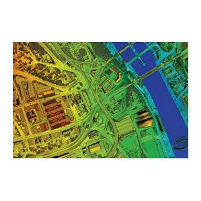
LiDAR - Height Data Software
LiDAR has become the de facto data source for those in need of detailed, accurate terrain information. A LiDAR sensor acquires the height of both the terrain, and any above ground features such as trees and buildings, to an accuracy and resolution unparalleled by other airborne methods.
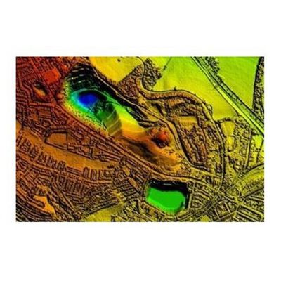
Standard Height Data Software (DTM and DSM)
Our detailed digital terrain and surface models (DTM and DSM) of England and Wales is available as a grid of heighted points and contours, both at 5m intervals (for the DTM) and 25cm intervals (for the DSM). Whether you’re interested in the terrain, or surface features such as buildings and trees, our data provides detailed height measurements at high accuracy and resolution. Bluesky height data facilitates the understanding, analysis and management of the environment that surrounds us. Bluesky has an unrivalled National catalogue of height data, which ensures that no matter where your area of interest is, we can provide you with the right information for your application. The data can be provided in a number of formats, enabling utilisation across a variety of software packages.
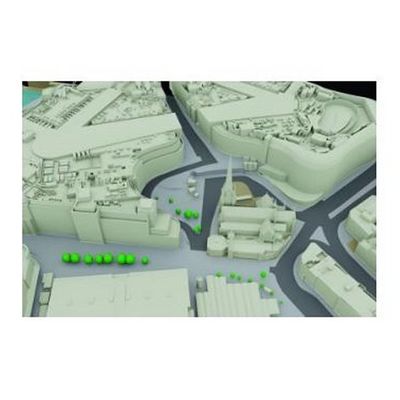
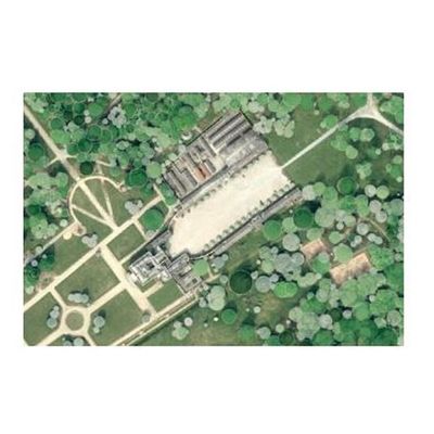
3D Building Models Software
Bluesky has direct access to the largest collection of high resolution stereo aerial photography in the UK, and we are therefore ideally placed to provide cost-effective, accurate and detailed 3D models of the urban environment, using advanced photogrammetric techniques.