
Arcv2CAD - Shapefile to CAD Converter Software
Arcv2CAD: Convert ArcView shapefile (.shp) to AutoCAD dwg/dxf. Arcv2CAD converts all ESRI ArcGIS 2D/3D Shapefile (Multipatch, Polygon, Points, Lines) to AutoCAD DXF, DWG or KML. Completely stand alone (does not require ArcGIS or AutoCAD). Convert Text Labels, Legends, Table data, Elevation data, colors and layers from Shapefile to AutoCAD DXF, DWG or KML. Convert multipatch and 2D/3D polygon to 3D objects in AutoCAD. Batch Conversion. Layer control determines layer names and selects entities on layers. Select Shapefile feature attributes to convert to DWG, DXF or KML. and more…
ARCV2CAD – Convert to DXF And DWG!
Although Arcv2CAD gives you plenty of options, it`s quick, easy to use, and will give you the results you want!
ARCV2CAD Named Point Markers
Apply names to markers, such that each name will correspond to a particular symbol.
New Features in ARCV2CAD

New features in Arcv2CAD version 7
- Output all DXF and DWG formats up to AutoCAD 2017
- Support direct access to shapefiles in ESRI Personal Geodatabase (.mdb) files.
New features in Arcv2CAD version 6.0
- Output AutoCAD 2010, 2011, 2012 DXF and DWG formats
- Larger + expandable main dialog
- Combine/Append DXF/DWG files to a single file
New features in Arcv2CAD version 5.0
- Output AutoCAD 2007/2008 DXF and DWG drawing formats
- Output Colors and Layers using BYBLOCK and BYBLAYER
New features in Arcv2CAD version 4.0
- Output AutoCAD 2004/2005/2006 DXF and DWG formats
- Output Surfer Blanking files, and XYZ text format files.
- Info_shapefile, and Info_dbf_field functions for Arcv2CAD DLL
- Additional marker types
- Output separate _INFO blocks
- Output text by itself
- Specify a rectangular region to translate
- Numerous minor enhancements to all operations
- Improved handling of very large shapefiles – more memory efficient
New Features in Arcv2CAD version 3.2
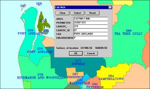
- Region filter
- Control Attributes (ATTRIB) positions
- Support 3D Shapefile types MultipointM,MultipointZ
- Lat/Long to WGS84/NAD83 projection
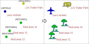
- Named Markers
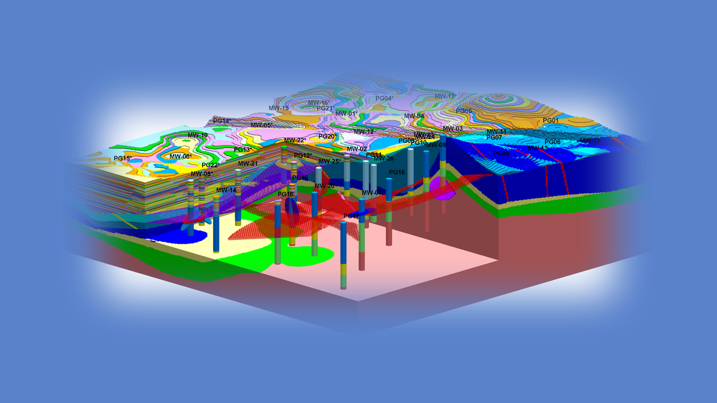
- Extrude 2D polygons to 3D objects (see inset)