- Home
- Companies
- ARIA Technologies
- Software
- ARIA Impact - Complete Health Risk ...
ARIA Impact - Complete Health Risk Assessment Software
ARIA Impact is a simple and user-friendly software. It is adapted to the needs of industrialists, design offices, air quality monitoring associations. This tool meets the regulation on air quality and provides the basic elements for a complete health risk assessment, to evaluate the olfactory impact of a facility or to achieve the Air and Health component of a development. road. It can simulate the long-term dispersion of atmospheric pollutants (gaseous or particulate) from all types of emitting sources (point, surface, linear) and calculate concentrations and deposits (dry and wet) expressed as annual average or percentiles. ARIA Impact TM now contains both the Gaussian AIM model already present in previous versions and the AERMOD model of the US-EPA.
Impacts of industries and car traffic on air quality
- Long-term statistical impacts of industrial or automotive emissions (odors, dust, gas, etc.)
- Comparison of the calculated concentrations with the regulatory values (annual average, percentiles, frequency thresholds ...)
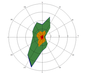
- Statistical analyzes of meteorological data (time series, wind roses)
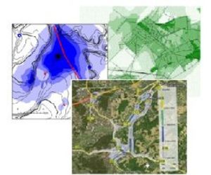
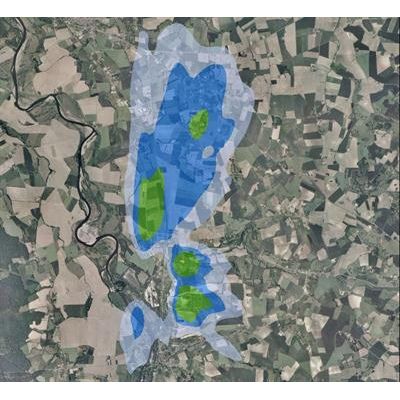
- Simple cartographic return of the results
- Compatibility with market GIS (ArcGIS, MapInfo ...), native graphical outputs under Google Earth
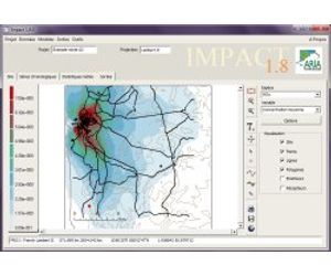
Full user interface
- Easy import of meteorological, topographic and atmospheric emissions (constant, with cyclical temporal variation, or occasional from Excel files) without limitation of number of species or sources
- Statistical treatment of meteorological data (time series, wind roses)
- Simultaneous treatment of different species: gaseous pollutants, particulate pollutants, odorous, radioactive, with calculation possible for an odorous mixture expressed in odor unit
- Car traffic module: conversion of NOx to NO / NO2, possible coupling with module for calculating automotive emissions (TREFIC)
- Simplified consideration of the topography, blocking of the mixing layer, specific module for calm winds, dust extraction module, taking into account the background pollution
- Extended range of results: map of concentration, deposits (annual average, percentiles, frequency of exceeding thresholds, values calculated at particular points)
- Possibility of taking into account a constant or varying background pollution over time
- Validation file available
Spatial scale : from 5x5 km to 30x30 km
Topography : complete compatibility with the topographic data of the main suppliers (IGN, USGS ...)
Meteorological data
- Time series of hourly or tri-hourly time acquired by a weather station or during a particular meteorological situation
- Compass
Emissions data
- Description of pollutants (gases, particles, odors)
- Emission values and characteristics of point sources (industries), linear (traffic), surface or volume (domestic heating, diffuse VOC emissions, etc.)
- Monthly, weekly or hourly variations for each source, or defining particular periods
- Vertical meteorological profiles calculated from measured ground data
Dispersion model
- Straight Gaussian dispersion model
- Taking into account the simplified topography
- Dry or wet deposition calculations
Types of calculations
- Academic calculation (modeling for one direction and wind strength)
- Statistical calculation from a wind rose (Taking into account the occurrence frequencies of a general wind rose)
- Statistical calculation from a complete meteorological file
Results
- Automatic generation of result cards
- Selection of species
- Modification of display properties (iso-values, colored surfaces, color gradients ...)
- Export values at the receiving points
Meteorological data
- Compass
- Time Series
- Export tabular data
Integration with GIS
- Native import of ESRI shapefiles (shp)
- Native export to Surfer, ArcGIS, MapInfo and Google Earth