

ARIA Technologies software
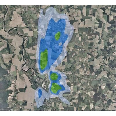
ARIA Impact - Complete Health Risk Assessment Software
ARIA Impact is a simple and user-friendly software. It is adapted to the needs of industrialists, design offices, air quality monitoring associations. This tool meets the regulation on air quality and provides the basic elements for a complete health risk assessment, to evaluate the olfactory impact of a facility or to achieve the Air and Health component of a development. road. It can simulate the long-term dispersion of atmospheric pollutants (gaseous or particulate) from all types of emitting sources (point, surface, linear) and calculate concentrations and deposits (dry and wet) expressed as annual average or percentiles. ARIA Impact TM now contains both the Gaussian AIM model already present in previous versions and the AERMOD model of the US-EPA.
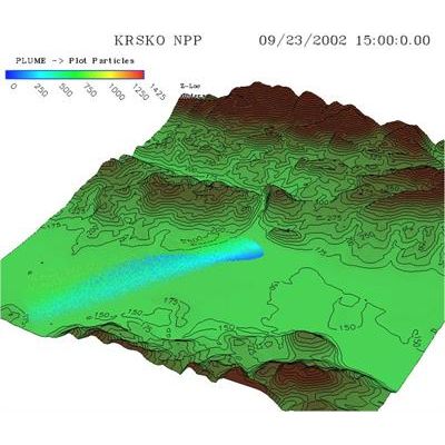
ARIA Risk - 3D Industrial Risks Software
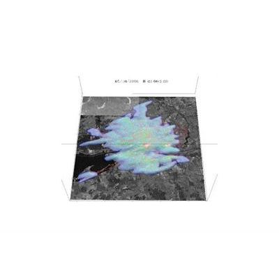
ARIA Risk is a 3D software for evaluating industrial risks related to the dispersion of toxic gases (storage accident, pipeline rupture, fire fumes, etc.). It allows mapping instantaneous or integrated concentrations (comparison with threshold values: lethal or irreversible effects) and safety distances (circles of danger ...). ARIA Risk is based on 3D calculation modules for meteorology and dispersion (puff or particle model) and takes into account the very complex topography, the effect of the buildings and the weak winds.
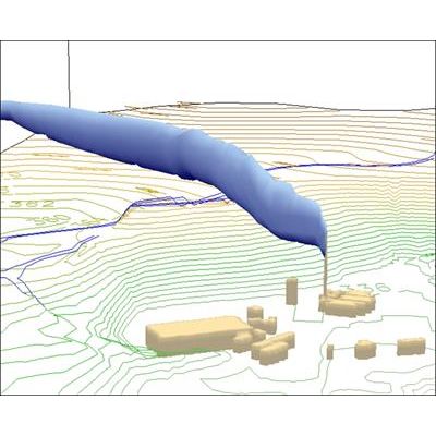
ARIA Local - Computational Fluid Dynamics Software
ARIA Local models up to a very small scale the pollution problems in urban and industrial areas (chronic and accidental releases) taking into account the obstacles (buildings, relief ...). ARIA Local can also be used for applications in micro-meteorology (wind sites, engineering structures) or inside buildings (clean rooms, controlled atmosphere areas, etc.). ARIA Local is a CFD (Computational Fluid Dynamics) calculation tool dedicated to the atmospheric environment, modeling of flow, turbulence and atmospheric dispersion.
ARIA Wind - Meteorological Data and Taking Software
Based on the assessment of the available energy resource, ARIA Wind is a tool for helping to design wind farms: evaluation of wind potential, optimization of the layout of the park, determination of the variability of energy production. Connected in real time to weather forecasts, ARIA Wind provides the operator with a reliable forecast of turbine production. ARIA Wind is a 3D model of wind field reconstruction adapted to the wind problem that can simultaneously integrate different types of meteorological data and taking into account the same complex topography.
ARIA Regional - Comprehensive System for Analyzing and Forecasting Regional Software
ARIA Regional is a comprehensive system for analyzing and forecasting regional and urban air pollution for gaseous and particulate pollutants (primary and secondary). It includes a set of modules to assess and manage emissions of pollutants from all sources: industries, traffic, natural sources, domestic sources ... Used in diagnostic mode, it allows to understand past pollution episodes . In forward-looking mode, it makes it possible to test the impact of measures intended to improve the air quality (urban transport plan, limitation of discharges, modification of the rolling stock, limitation of industrial discharges, composition of fuels, etc.) . In forecast mode, through the use of a medium-scale weather forecast model.
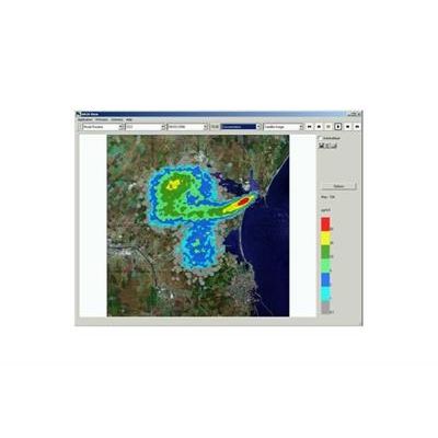
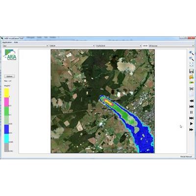
ARIA View - Air Quality Monitoring System
ARIA View is a continuous modeling air quality monitoring system that allows manufacturers to monitor real-time air quality over and around a site to regularly inform authorities and residents of the impact of industrial activity on their atmospheric environment. ARIA View also allows production managers to predict future air quality at the site based on weather conditions and forecast emissions, and to respond accordingly. ARIA View uses the Parallel Micro-SWIFT-SPRAY (PMSS) software. Connected online to meteorological sensors and / or emissions, it is therefore a real air quality management system.
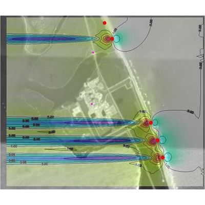
ARIA Impact3D - Air Quality Management Software
ARIA Impact3D is a software allowing industrialists to know the chronic impact of their installation on air quality by simulating real or virtual emission scenarios. It simulates in 3D the atmospheric dispersion of pollutants (gaseous or particulate) from channelized and fugitive sources taking into account in detail the topography, the effect of buildings, and several simultaneous meteorological data on the ground and at altitude, in particular meteorological profiles measured or planned. ARIA Impact3D is intended for industrialists, design offices and local authorities involved in the monitoring of industrial zones. It is a detailed chronic risk assessment software that integrates a 3D Lagrangian dispersion module.
ARIA City - Environmental Managers Software
City Environmental Managers need to address particularly complex atmospheric dispersal issues related to the diversity of the urban landscape and road traffic emissions. To answer this question, they use a 3D digital representation of the urban environment (roads, topography, buildings) that allows the effects of confinement of the various obstacles to be taken into account. Urban data is usually grouped by the city in a geographic information system (GIS). ESRI ArcGIS Desktop is one of the most popular products. ARIA City fully supports ArcGIS `data storage standards and graphical tools by providing a direct and simplified link to models for calculating the impact of atmospheric emissions.