

- Home
- Companies
- PCI Geomatics
- Software
- DataEM - Version LandScapeâ„¢ - Point ...
DataEM - Version LandScapeâ„¢ -Point Cloud Editing Toolkit
Summit Evolution takes 3D stereo vector digitizing to a new level with its integration of digital stereoplotter, CAD and GIS interfaces, 3D stereo vector superimposition, automated feature editing and contour generation.
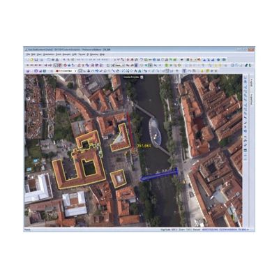
Through its unique and customizable CaptureTM interface, image features from a Summit Evolution project are digitized directly into AutoCAD®, MicroStation® or ArcGIS®. DAT/EM SuperImposition™ is built into every Summit Evolution system, which is offered in three different product level packages as well as a new Summit Evolution Mobile option.
Additionally, integration with the LandScape™ point cloud editing toolkit is standard. Supported image sources include digital and scanned aerial film imagery, matrix and push-broom digital airborne sensors, small- and medium-format metric cameras, close-range imagery, orthophotos, LiDAR, synthetic aperture radar, and satellites.
- Supports monochromatic, panchromatic, three-channel and multi-channel multispectral imagery and provides channel mapping so you can view any image band combination.
- Digitizes 3D vectors directly into AutoCAD, MicroStation, or ArcGIS using DAT/EM’s robust, world-class Capture interface.
- Unlimited zoom levels, fast pan, and automatic loading of adjacent stereo models, with superimposition of CAD and GIS vectors over the image view
- Essential tools such as Terrain Visualization to check point and vector accuracy, Contour Creator to create elevation contours and TINs, and Point Translator prepare large point files.
- DAT/EM Ortho+Mosaic™ module for easy and precise creation of orthophotos and orthophoto mosaics.
- Summit Evolution Mobile package available which runs on touch screen tablets with Windows 8 in the Summit anaglyph stereo mode.
- 64-bit and 32-bit applications available.