

Geolitix Technologies Inc.
- Home
- Companies
- Geolitix Technologies Inc.
- Software
- Drone GPR Software
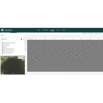
Drone GPR Software
Data from airborne GPR surveys can be processed with discrete targets and horizons displayed in 3D and exported to Google Earth™.
Most popular related searches
ground penetrating radar survey
ground penetrating radar software
ground penetrating radar system
airborne survey
In recent years, mounting GPRs onto drones has become popular. Although flying with GPR systems at heights above 1 m is illegal in many jurisdictions (USA, Canada, and Europe), there are specific applications where such deployment is advantageous (e.g., glaciers and ice-covered lakes). In other settings, most of the signal strength is lost at the air-ground interface, limiting penetration depth. Geolitix can process data from such systems to extract meaningful results.