

Geolitix Technologies Inc.
4 software found
Geolitix Technologies Inc. software
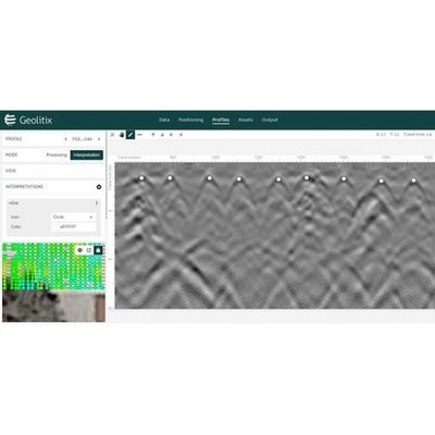
Geolitix - Rebar and Bridgedecks Software
Rebar in concrete and bridge decks is automatically detected and positioned in 3D, allowing the system to generate maps of rebar depths and corrosion conditions in Google Earth™.
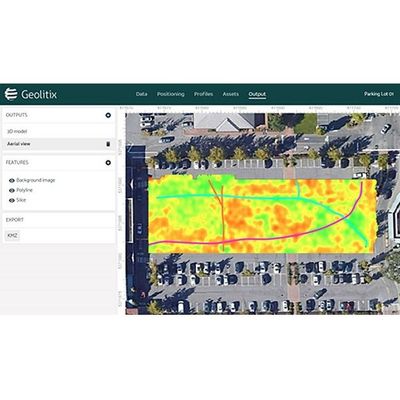
Geolitix - Utilities Mapping Software
Pipes, cables and USTs are easily detected and mapped using single or multi-channel GPR data for output to AutoCAD™ or Google Earth™.
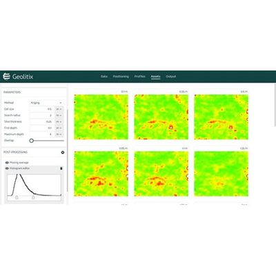
Geolitix - Geological Mapping Software
Data from low-frequency GPR systems can be interpreted in a 3D-aware environment to build exportable geological models.
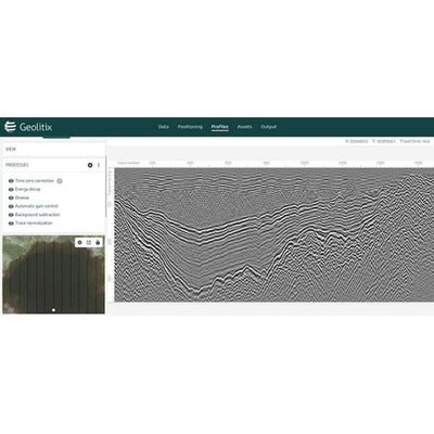
Drone GPR Software
Data from airborne GPR surveys can be processed with discrete targets and horizons displayed in 3D and exported to Google Earth™.