
Simutech
pocket eHIS - Environmental and Geodetic Data Software
FromSimutech
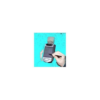
pocket eHIS offers the possibility to access environmental and geodetic data from a central HIS3D database in the field - e.g. using cellular connections via GSM or GPRS. pocket eHIS writeable allows for data acquisition on site. Collected data is then transmitted to the central database.
Most popular related searches
geodetic data
meteorology data
environmental monitoring
environmental data
environmental data software
groundwater flow
geodetic software
water data
groundwater data
water information
Applications and Users:
- operators, inspecting measurement stations
- negotiations and proceedings in connection with new buildings and environmental measures
- You will never be angry again because of data you have forgotten in your office!
- ship navigators, asking for current river ground information and water flow data being on their ship
- querying meteorological data in the field for the public (sports events, farmers)
Environment:
- Data values are stored in a HIS`3D® database (querying other databases is possible via a gateway).
- An internet server with eHIS InterStore is installed (optionally inside the company).
Technology:
Client:
- Java, HTTP/HTML
- PocketPC 2002; e.g. Compaq iPaq 3850
- GSM/GPRS; optional: GPS
Server:
- Java, Servlets, HTTP/HTML