
- Home
- Companies
- Locus Technologies
- Software
- Locus - Environmental Data Mapping ...
Locus - Environmental Data Mapping Software
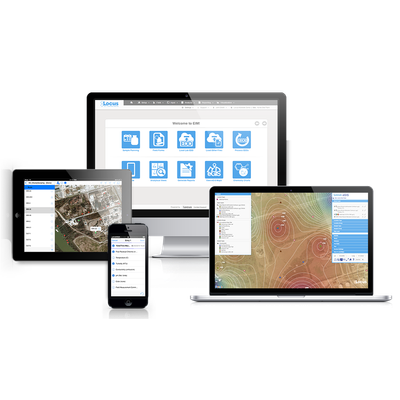
Locus enriches our environmental software and data visualization tools with geographical information systems. GIS offers sophisticated methods to visualize layers of environmental data in the context of the land, communities, watersheds, and landmarks around us. Locus clients can choose GIS visualization using Google Maps or our premium GIS solution, GIS+, which utilizes smart mapping from ESRI ArcGIS Online.
The smart-mapping module enables spatial data inclusion for enhanced analysis, using functions like spatial query, classification, time series analysis, buffering, and more. Locus GIS+ includes contour and topographic maps, Voronoi diagrams, choropleth and point density maps, heat maps, and time sliders.
Locus GIS+ is a convenient and powerful complement to remediation projects, compliance, and sampling activities. This new dimension of knowledge leads to impactful discoveries and informed decision making.
- Enables analysis across a portfolio of sites
- Point-and-click, or craft custom queries for perfect results
- Post data in easy-to-read text boxes
- View changes over time with built-in time sliders
- Create contours using multiple algorithms
- Export to a variety of formats
- Easily share maps with your team from the dashboard