

FIND - Geology Maps - Large & Small Scale Software
Geological maps are useful to a wide range of businesses with interests in planning and development as well as more academic aspects such as the Earth’s geological history, its fossils and its landscape development. All our geological mapping information is sourced from the British Geological Survey (BGS).
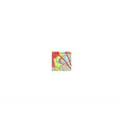
Modern large scale (1: 10 000) and small scale (1: 50 000) maps commonly show up to five themes of geological information:
This layer is made up of linear features representing faults, rock units, fossil horizons, landforms and structural features.
Artificial ground is a term used by the BGS for those areas where the ground surface has been significantly modified by human activity. Whilst artificial or man-made ground is not part of the `real geology` of bedrock and superficial deposits it does affect them. Near surface ground conditions are very important to development so artificial ground needs to be recorded.
Artificial ground includes:
Landslip deposits are primarily superficial deposits that move down slope, resulting from gravity. Caution should be exercised when building on a landslip deposit because of the potential hazard caused by ground instability.
Superficial deposits (formerly known as `drift` by the BGS) are the youngest geological deposits, formed during the most recent period of geological time. Most of these superficial deposits are unconsolidated sediments such as gravel, sand, silt and clay forming relatively thin, often discontinuous patches or larger spreads.
Bedrock geology (formerly known as `solid` geology by BGS) is a term used for the main mass of rocks forming the Earth. Bedrock is present regardless of whether it is exposed at the surface in outcrops or is concealed beneath superficial deposits or water.
FIND does not interpret the geological information in any way. If you wish to find out further information or buy a detailed report please contact the BGS directly.
Metadata
Layer Information
- Data provider: British Geological Survey
- Sample of 10k data: Sample (10k) layered PDF
- Sample of 50k data: Sample (50k) layered PDF
- 10k coverage area: Sporadic throughout Britain
- 50k coverage area: Britain (excl. areas of central Wales)
Data currency
- Version date of dataset: 2017
- Frequency of update cycle: Annual
Map screen options
- Viewable in map window: Yes
- Viewable on map backgrounds: All map backgrounds except FIND Map / OS Plan
- Viewable between scales: 1: 3 001 - 1: 150 000
Print options
- Printable: Yes
- Printable between scales: 1: 3 001 - 1: 150 000
Export options
- Exportable: Yes
- Export formats: DWG, DXF, TAB, SHP
- Maximum export size via internet: 10 000 hectares (100 km²) for 10k 20 000 hectares (200 km²) for 50k
Saved project options
- Period layer saved for viewing (without incurring further costs): 12 months
- Period print saved for (without incurring further costs): 12 months