

GAEA - Version SE-Map -Geotechnical Extension Module Software
This extension module of StrataExplorer is used to grid and contour data. The module can grid and contour many types of boring and well data, stratigraphic data from cross-sections, and other types of data. This version of the module has been specifically designed for the environmental industry After the data has been entered in the WinLoG and WinFence modules, it can be automatically extracted and used to generate contour maps.
The data can be gridded with 6 different common gridding algorithms. The grids can cover the entire map area or be constrained to a polygonal area. Individual grid nodes can be subsequently edited. Areas of grids can be blanked to represent zones of no data. Several types of mathematical operations can be performed on one or more grids.
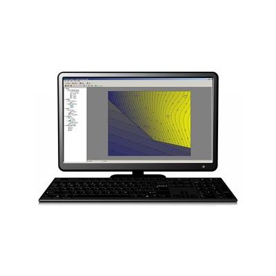
Contour maps can be drawn with contour lines, color fill, or colored contour lines. The labels on the contours can be easily moved and deleted as required. After the contour map has been created, it can be overlain on top of the project map. In addition, the contour map and any solids constructed from the top and bottom contours of strata can be displayed in 3D.
- A wide variety of data can be automatically extracted from borings and wells.
- Strata boundaries defined in the WinFence module can be used to create contour maps in contour module.
- Diverse types of data can be shifted and merged.
- Points in datasets can be edited and stored separately from the derived points from borings, wells, or cross-sections.
- Statistics can be calculated on datasets.
- Mathematical operations such as unit conversion; add, subtract, divide, and multiple by a constant; minimum and maximum limits; raise to a power; logarithm; and square root can be applied to a dataset.
- Two datasets can be added, subtracted, multiplied or divided.
- High and low pass filters can be applied to a dataset.Data can be gridded using Natural Neighbor, Inverse Distance, Modified Sheppard, Minimum Curvature, Trend Surface, and Nearest Neighbor.
- Grid intervals can be entered, estimated, or copied from another grid.
- Grids can either cover the entire project area or a polygonal subset of the area.
- Areas of grids can be blanked to represent zones of no data.
- Mathematical operations can be performed on one or more grids,
- Individual grid node values can be edited.
- Contour maps can be drawn with contour lines, color fill, or colored contour lines.
- Contour intervals can be entered or estimated.
- Individual contour levels can be edited for greater control.
- Labels on contour lines can be easily moved and deleted.