- Home
- Companies
- Advanced Geophysical Operations and ...
- Software
- Geological Cross-Section (GCS) Software
Geological Cross-Section (GCS) Software
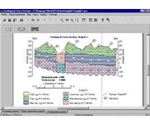
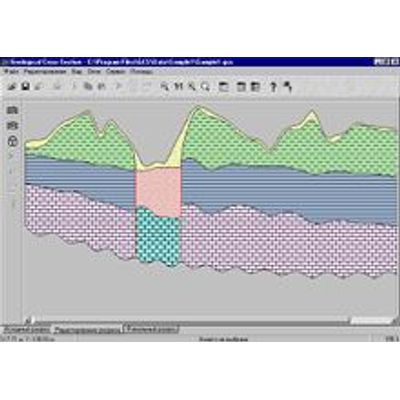
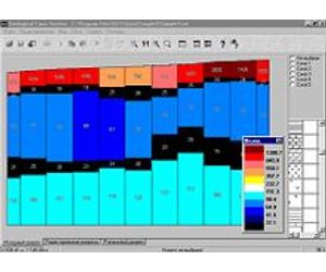
Geological Cross-Section (GCS) software is intended for constructing report quality geological cross-sections based on the results of profile interpretation of electromagnetic soundings. This program possesses a convenient, intuitively intelligible user interface and many special capabilities.
In modern times, geophysical organizations must deliver customers high quality interpretation results, and do so in a very short time. However, the professional means of compiling vector graphics - such as Corel Draw, for example - do not make it possible to rapidly construct geological cross-sections of required quality, especially when a non-expert in the graphics field has to work with such software. GCS software allows the user to construct report quality geological cross-sections according to the results of profile interpretation without requiring significant time expenditures or special vector graphic software skills.
GCS software allows the user to perform the following operations:
- Import the results of profile interpretation from files formatted to corresponding programs
- Construct geoelectric cross-sections
- Assign geological madders (either predetermined or created by user) to layers and blocks of geoelectric cross-sections
- Smooth out and move the boundaries between different geological formations
- Plot dyke lines and mark rivers, bore holes and pickets on the obtained cross-sections
- Automatically create and edit the legend, scaling, depth axis and title
- Assign horizontal and vertical scale and print out scaled cross-sections
- Export images into the standard vector graphic software