

Advanced Geophysical Operations and Services Inc. (AGCOS) software
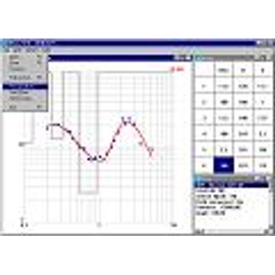
Model MT-Corrector - Curve Viewer and Editing, Spline Graph Plotter Software
MT-Corrector software is intended for the viewing, editing and constructing the smooth spline approximations of the frequency dependences of tensor impedance components. Program has the advanced graphic user interface and large number of special capabilities. It is capable of being important part of practically any software bundle, intended for processing and interpretation of MT data.
TOSTER - Model MT - Data Inversion Software
This program is intended for MT data inversion along the profile and on the grid. The nucleus of the program is a direct one-dimensional algorithm for calculating the MT field. The parameters of inversion include entering the amplitude-phase curves for separate MT sites, their calculation errors, the geometric arrangement of sites on the profile (grid), and a priori information about the geoelectric properties of the grid being investigated.
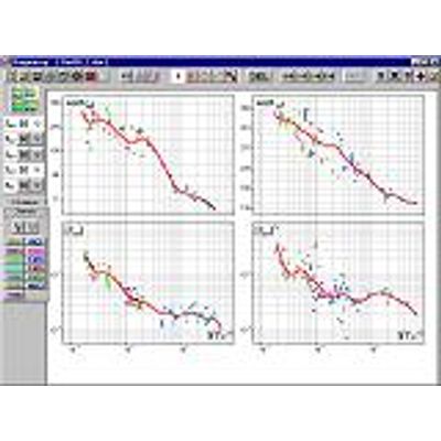
MTS PROF - Model MT - Interpretation Software Package
Software is intended for MT data normalization, the analysis and interpretation along the profile and on the grid. Build-in functions based on the document templates allow user to export results to Grapher and Surfer and allow user to make quick and good quality reports, freeing him from the routine work. The realized in the program, normalization of MT-data is based on the analysis of the graphs of the modules of tensor impedance components along the profile (grid). There is an option for automatic normalization for the selected period, total conductivity of sediments or manually. A dynamic change in the images of the frequency cross-sections of tensor parameters, curves and polar diagrams on the selected MT site allow to control the process of normalization.
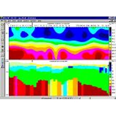
Model MSU-MT1D - 1D Profile MT Data Interpretation Software
MSU_MT1D software is intended for one-dimensional profile MT data interpretation. It possesses multifunctional graphic user interface and has options for manual or automatic MT curve selection, apparent resistivity and phase impedance cross-section analysis, analysis of geoelectric cross-sections along the profile, and so on. During a field survey, the key issue is data interpretation. MSU_MT1D software has a wide range of capabilities for carrying out profile MT data interpretation. Its main advantage is a well designed graphic user interface, which gives the interpreter versatility when analyzing data and obtained models, thus utilizing to the fullest extent weakly formalized a priori information and personal experience.
Model MSU-FS1D - 1D FDEM And MT Data Modeling Software
MSU_FS1D software’s main purpose is to solve straight and inverse FES problems. It allows the calculation of all the components of a low-frequency field of basic dipole sources on the surface of a horizontally layered medium (taking into account its polarization). The program’s graphic user interface makes it possible to effectively achieve interpretation of FES curves.
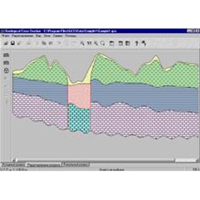
Geological Cross-Section (GCS) Software
Geological Cross-Section (GCS) software is intended for constructing report quality geological cross-sections based on the results of profile interpretation of electromagnetic soundings. This program possesses a convenient, intuitively intelligible user interface and many special capabilities.
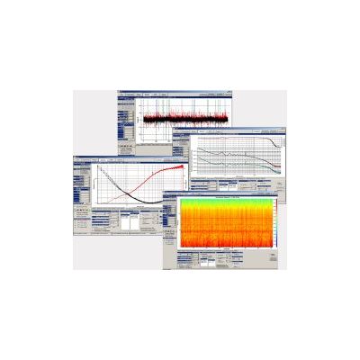
Model ACF-4M - Data Processing and Interpretation Software Tools
The SM27 program is intended for equipment ACF-4M operation control and data processing with apparent resistivity and impedance phase curves obtaining. Output data formats are *.sbf, *.laf and *.txt. Data of the SM27 program can be used in the Geoinf32, MEL and Shell2d programs, and also in the WinGLink software package. The SM27 program fulfills initial testing and control of the equipment operation, setting of equipment parameters (numbers of magnetic coils, lengths of electric lines, azimuths of magnetic and electric sensors, etc), setting of measurement’s parameters (duration, frequency range, recurrence), application of magnetic coils, preamplifier of electric channels and recorder calibrations, connection the recorder to PC, viewing and estimation of data quality (time series, auto- and cross spectra of signals, dynamic spectra, apparent resistivity and impedance phase curves).
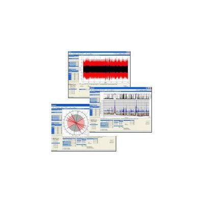
Model RMT - Data Processing and Interpretation Software
The SM25 software is intended for the RMT equipment operation control and data processing (obtaining of apparent resistivity and impedance phase curves). Output data formats are *.sbf, *.laf, *.edi and *.txt. Output files of the SM25 software can be used in the Geoinf32, MEL and Shell2d programs, and also in the WinGLink, Zond MT1D, Zond MT2D inversion software packages.
Zond Software - Potential Methods
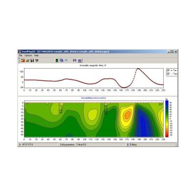
Model ZondMAG2D - 2D Gravity and Magnetic Interpretation Software
The program is designed for 2D magnetic and gravity 2D modeling and interpretation in two (2) versions: land/surface; airborne. Single and easily understandable data format is used in the program, but main known data formats are supported.
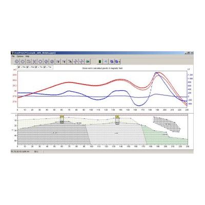
Model ZondPGM - 2D Gravity and Magnetic Interpretation Software in Polygonal Way
ZondPGM is designed for 2D interactive and automatic 2D gravity and magnetic data interpretation in ground and airborne versions. In comparison to ZondMAG2D program, ZondPGM uses the polygonal way of describing petrophysical medium. Such approach provides some advantages for data interpretation. The primary model construction is accomplished via creation of a number of closed polygons of somewhat limited geometry with stable magnetic or gravity properties inside each polygon. Due to very convenient interface it is possible to very quickly create complicated model. Calculations take into account the host rocks properties, as well as surface topography, full magnetic field vector inclination, regional anomalies, etc.