

- Home
- Companies
- Geoscanners AB
- Software
- GeoPointer X - GIS package for Ground ...
GeoPointer X - GIS package for Ground Penetrating Radar Applications
GIS package for Ground Penetrating Radar applications. Combines the geolocation data obtained from a GPS receiver with the data obtained by the radar system. Accepts geolocation data produced by other software packages or hardware.
GeoPointer X© serves the needs of a wide audience of users, from construction companies to geophysical consultants. A unique feature of this software is that it combines in one single system the many aspects of a survey, the coordinates coming from the GPS receiver, the positions on the map, pictures of the surroundings and many other useful information. For instance, it is possible to use GeoPointer X© to inspect roads, street lights or any other of the infrastructure objects.
The end user has multiple choices to control the software. All the data is stored in one single database and that makes the post processing of the acquired information a more simple and harmonic task.
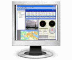
While using GeoPointer X© it is possible to choose which of the data windows you need to display. One can have all data windows open or only a few of them, this will not be reflected in the amount of data collected or the quality of it. The only window that demands to be open, in order to store the data, is the photo data view.
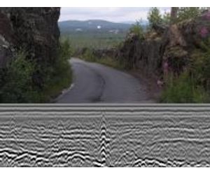
GeoPointer X© brings new possibilities to the way geophysical data is analyzed, not only the data from the geophysical instrument is available but also a whole set of data about the survey location. Using GeoPointer X© together with our triggering devices gives a real possibility of linking the ground penetrating radar data with a database describing the site where the data has been collected. [user manual]
In other words, combining the geophysical survey data and the data stored in GeoPointer X© it is feasible to see both sides of the surface. The post analysis of the data will reveal the features available under the surface together with a picture of the surroundings above the surface. This linked data give us a better idea of the survey site and its position. This information can be used while writing reports or detailed descriptions of a site.
GeoPointer X© does not require special GPS receivers or cameras, quite good results are accomplished with the aid of relative inexpensive equipment. We used the software with different kind of GPS receivers, Bluetooth®, RS232 and USB ones. The only requirement to the GPS receiver is that it has to output NMEA 0183 sentences. [user manual]
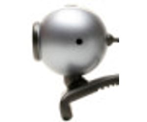
We tested different web-cameras, from very inexpensive models to a little bit more sophisticated ones. We reached the conclusion that all depends on the amount of light that reaches the camera lenses, with daylight and no direct sunlight reaching the lenses almost all cameras gave acceptable results. During nightfall or under very bright conditions, we were able to get good results only using a web-camera SPC900/NC from Philips.
GeoPointer X© does not require expensive maps formatted in some specific way. The maps can be digital ones or even scanned images from paper maps. The only requirement to the map you are planning to use is that at least two exact coordinates must be known on it. [user manual]
The software can use maps of different sizes and resolutions. GeoPointer X© selects from all the available maps the one that suits best the coordinates coming from the GPS receiver. This function can be switched off if the user wants to do so.GeoPointer X© will load automatically a new map from all the available ones every time the coordinates coming from the GPS receiver go out of the boundaries of the currently displayed map.